Around The World On Hokule'a
Australia
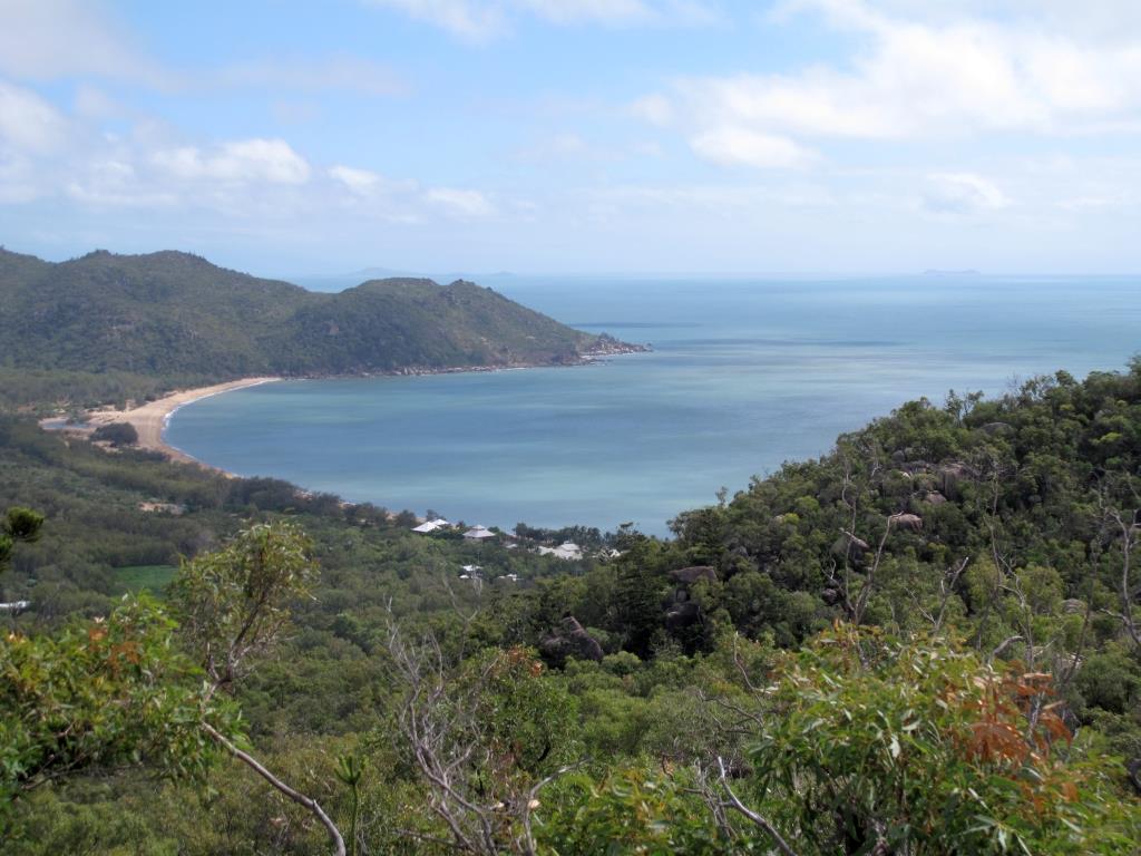
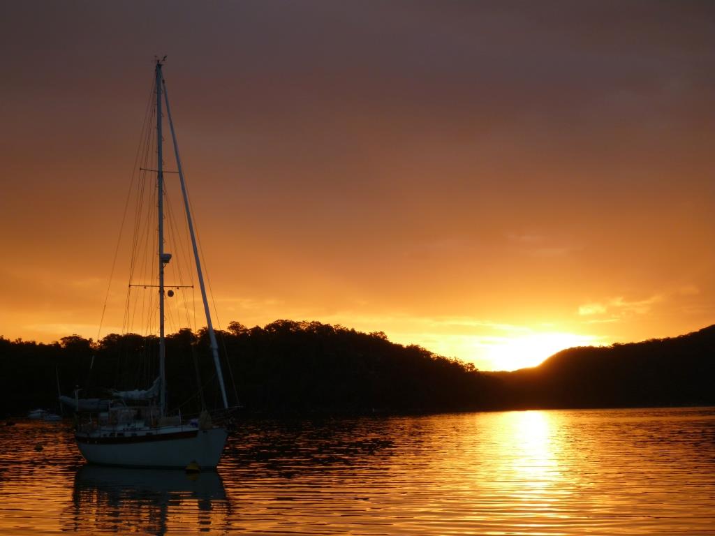
Saturday, July 27, 2013 – Cape Don, Northern Territory, Australia
We left Darwin this morning at 2am with the intention of sailing direct to Indonesia. However, with nearly a full moon and spring tides running, the current pushed us along at 8-9 knots. This meant that we would likely arrive at our first stop in Indonesia in the dark, so we decided to stop at Cape Don to spend one more night on this amazing A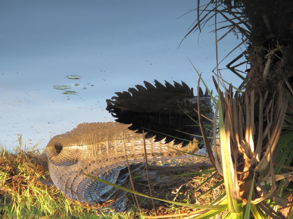 ustralian continent.
The past few weeks have been a complete blur. Initially, there was a great sense of satisfaction and a sigh of relief when we finally arrived in Darwin after 3 months and 3000 miles since leaving Sydney. But that quickly faded as we started to realize how much work and planning still needed to be done for Indonesia. Fortunately we had decided to join the Sail Indonesia Rally (a government sponsored program for boats wanting to visit Indonesia) which certainly helped with much of the paperwork and bureaucratic requirements necessary to take a boat into Indonesia. But still the “ to do” list was dau nting; obtaining visas, getting Indonesian currency, doctor appointments, quarterly financial updates, provisioning, getting diesel, gasoline, propane, and of course more than a few maintenance and repair projects for Hokule’a. Probably the biggest challenge was provisioning. For the past 9 months we have been in an English speaking “Western” country where we could pretty much get anything we wanted and now we were preparing to go to a non-English speaking Muslim country with limited provisioning opportunities and where many things are simply not available (ie: milk, cheese, wine, pork, toilet tissue, etc). We also, as I mentioned in the previous update, had done very little research about w
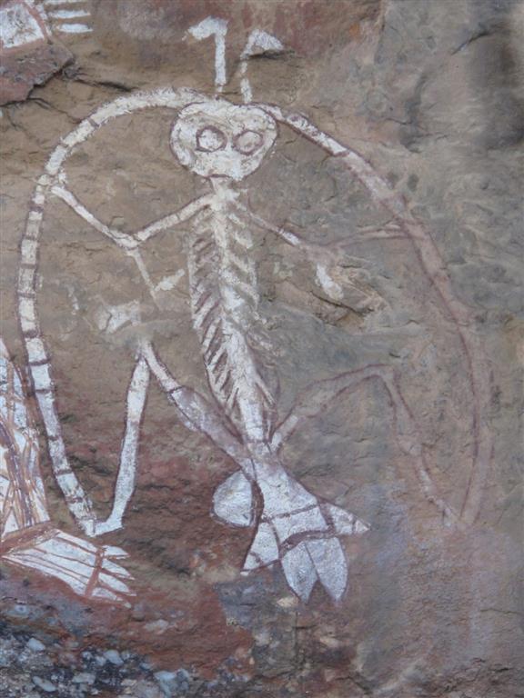 here we wanted to go in Indonesia and needed to put in some significant time looking at charts, cruising guides, and our favorite navigational tool…google earth.
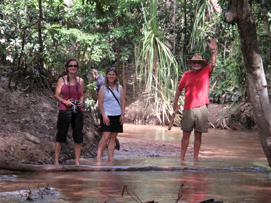
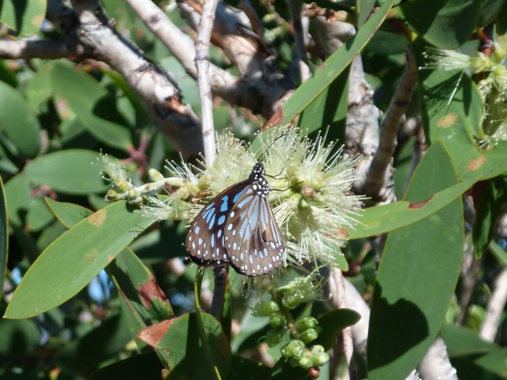
Originally we had planned to rent a car in Darwin and spend a couple of weeks travelling around the northern and central parts of Australia, but obviously that wasn’t going to happen with the looming to do list. So instead we rented a car for 4 days, loaded up our camping gear and headed to Kakadu National Park. Kakadu is Australia’s largest national park and it has one of the most diverse landscapes that I have ever seen. It is a combination of mangrove lined coastal areas, massive flood plains, low land hills, forests, lakes, rivers, and outback desert. Here we got to see an amazing array of birds and wildlife including dozens of saltwater crocodiles (one of which was over 15 feet long). But the main reason we went to Kakadu was t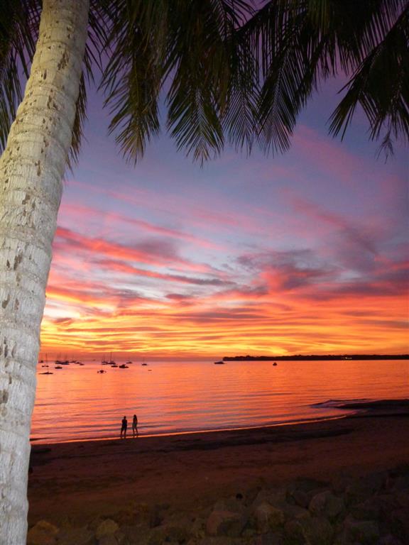 o see the ancient Aboriginal rock art sites (cave paintings) that were created by the Aboriginal people who have lived in this area for over 50,000 years. Our time in Kakadu went by way too fast and the next thing you know we were back in Darwin frantically trying to get everything done.
So tonight is the first chance that we have had to really relax in a while and what better way to do it than by watching another beautiful Australian sunset and reflecting on the past 9 months that we have spent in this amazing country. Cheers Australia!
July 26th, 2013 - Darwin, Australia
We finally arrived in Darwin about 2 weeks ago and so much has happened since our last update. Unfortunately we don't have time to get it all posted before we leave for Indonesia....tomorrow morning! That's right tomorrow m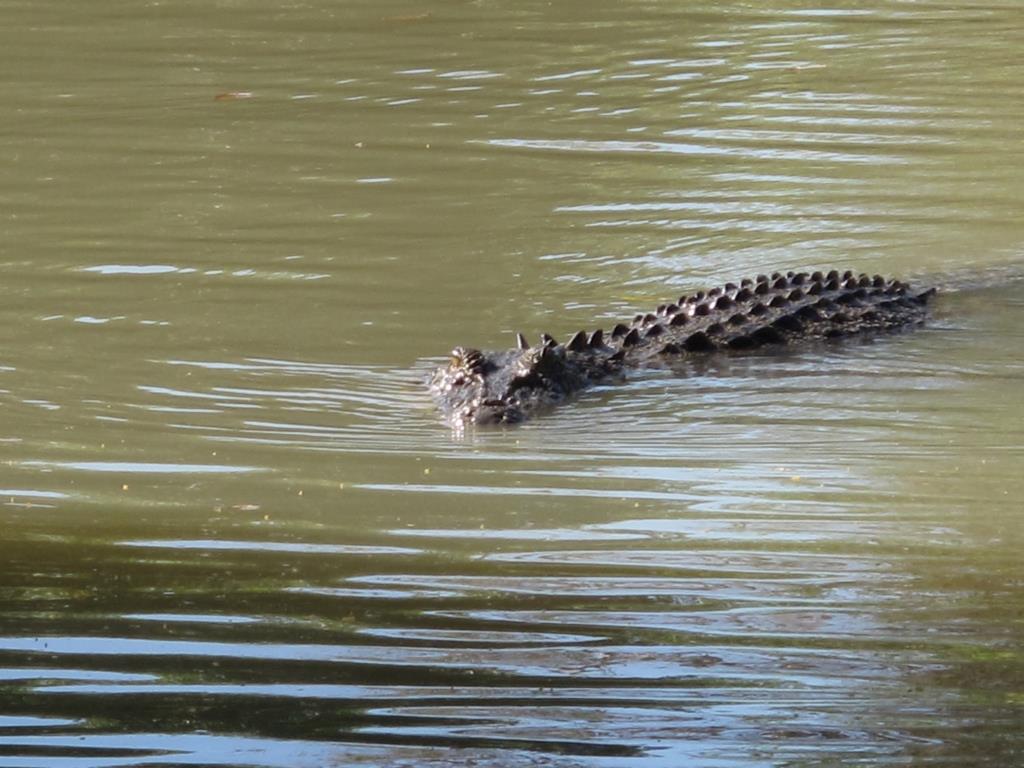 orning. It is not typically like us to be indecisive, but for the past 2 weeks we have been trying to make a decision on which route to take through the first part of Indonesia. Just this morning we finally made the decision to take the longer, slightly more difficult, off the beaten path route. Because of that, we have no idea when we will have access again to internet. But we will get the updates posted as soon as we do. We are definitely a little sad to leave Australia, but know that it is time to get going. Indonesia is going to be very different and very exciting...
Saturday, June 29, 2013 – Gove, Northern Territory, Australia
During our visit to Redondo Beach back in March, we had a chance to see our friends Jim and Emma on the boat Blue Sky, who finished their circumnavigation just as we were getting started with ours. Over dinner one evening they provided us with tons of great information about northern Australia and the next leg of our trip through Southeast Asia. While we were in Seisia (waiting for a weather window to cross the Gulf of Carpentaria), I was flipping through the notes that I had taken during dinner with Blue Sky and saw a quote from Jim about the Gulf of Carpentaria. “The Gulf was ass kicking! Worst sail of our entire circumnavigation. Wait as long as you have to for a forecast with no wind and motor across the whole damn thing!” We took Jim’s comments to heart and for the past several weeks have been monitoring reports from boats ahead of us about their crossing of the Gulf. Consistently most boats were reporting miserable trips with rough and confused seas.
I could write an entire journal entry on all of the various theories as to why it can be so rough in the Gulf, but for the most part it is due to it being so shallow. It is also where multiple ocean currents converge and it is so large that it often has multiple weather patterns. Gone were the days of heading out in 30 knots of wind, knowing that the Great Barrier Reef would protect us. We were heading back into the big bad ocean now. So we waited in Seisia .
It seemed that all the boats in Seisia had been given similar advice because on Wednesday morni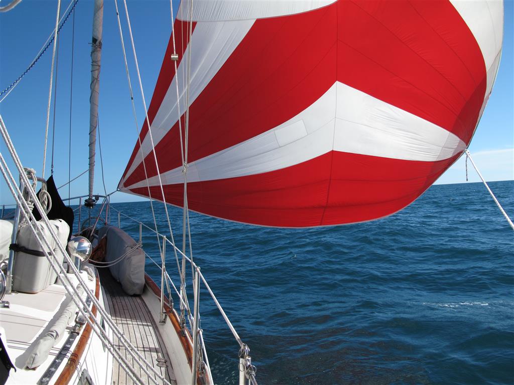 ng, with a 3 day forecast of winds from 5 to 15 knots, 11 boats including Hokule’a pulled anchor and set off on the 360 mile trip across the Gulf of Carpentaria. We got really lucky in that the weather ended up being pretty much what was forecast and we enjoyed a wonderful two and a half day trip across the Gulf to the town of Gove with sunny skies and moonlit nights.
Gove is basically a small mining town that has a good protected harbor and a small yacht club, but not much else to attract cruisers. The reason that we chose to come here is that Gove located in an area called Arnhem Land that has been home to a group of Aboriginal people called the Yolngu for over 40,000 years. Up until the 1960’s (when mining operations began), this area of Australia remained relatively undeveloped which allowed the Yolngu to continue living in their traditional way. Unlike many of the places we have visited where customs and tradition have been lost due to western influence, the Yolngu and other groups of Aboriginal people in Arnhem Land have been able to retain their culture and still live by it today.
We rented a car with Kite and Far Star and had a chance drive through parts of Arnhem Land and to visit the Aboriginal community at Yirrkala. Their culture and customs are utterly fascinating and hopefully I will be able to write more about that in a future update. From a moiety system that dictates who you can marry and what animals you can hunt to a justice system that results in being speared in the leg for punishment. This is a land where people have learned how to survive for thousands of years in an extreme climate with seasonal fluctuations that range f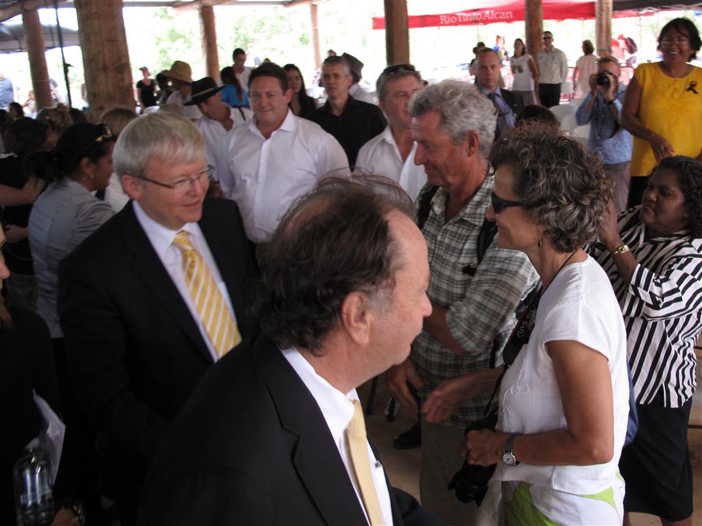 rom arid hot outback to massive floods created by cyclones.
We also had a unique opportunity to attend a memorial service for a famous and influential Aboriginal man named M Yunupingu. He was probably best known as the lead singer of a band called Yothu Yindi that had a number one hit in Australia in 1991 called Treaty. The song is about a broken promise by the Australian Government of a treaty with the Aborigines that would have allowed for Aboriginal self management, acknowledgement of land rights, compensation for loss of lands, respect for Aboriginal identity, and an end to discrimination. It was the first time in Australia’s history that an 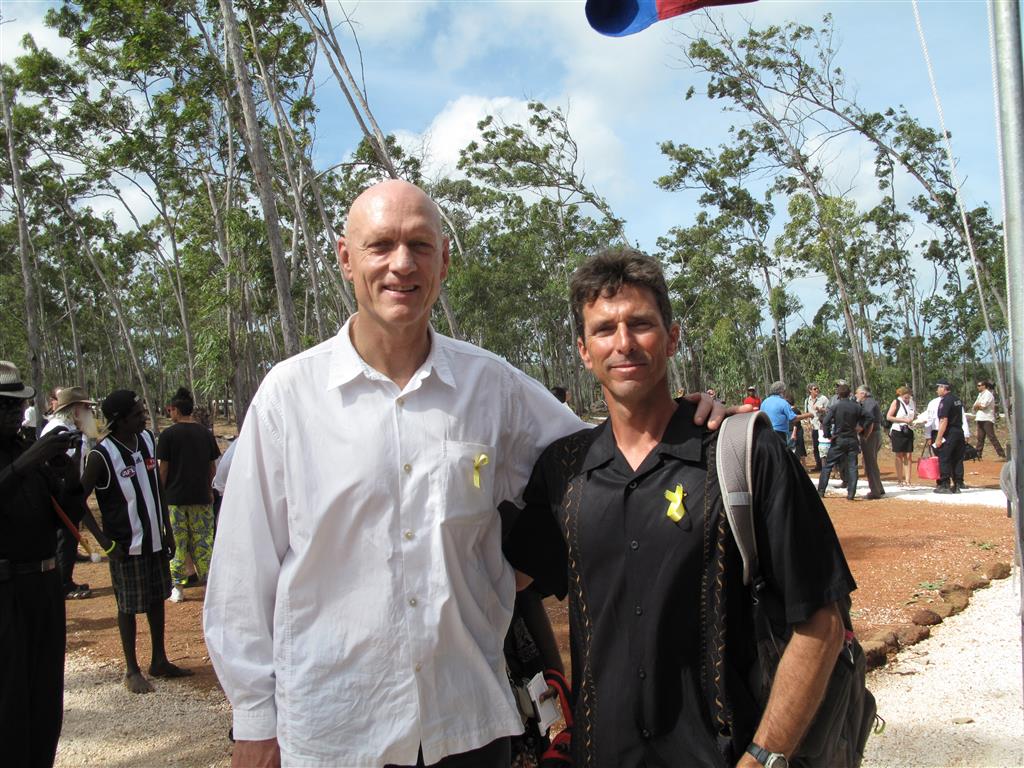 indigenous band had broken into themainstream, but more importantly it brought about an awareness of the Aboriginal issues both nationally and internationally. Yunupingu utilized the success of Yothu Yindi to lobby and implement reform in the Australian education system that allowed traditional Aboriginal teachings alongside Western methods. In the Aboriginal community he was best known as an educator and a leader.
The memorial service was held in a very remote place called Gulkula, yet it was attended by a number of prominent politicians (including the Prime Minister) and famous musicians including Peter Garret (lead singer of Midnigh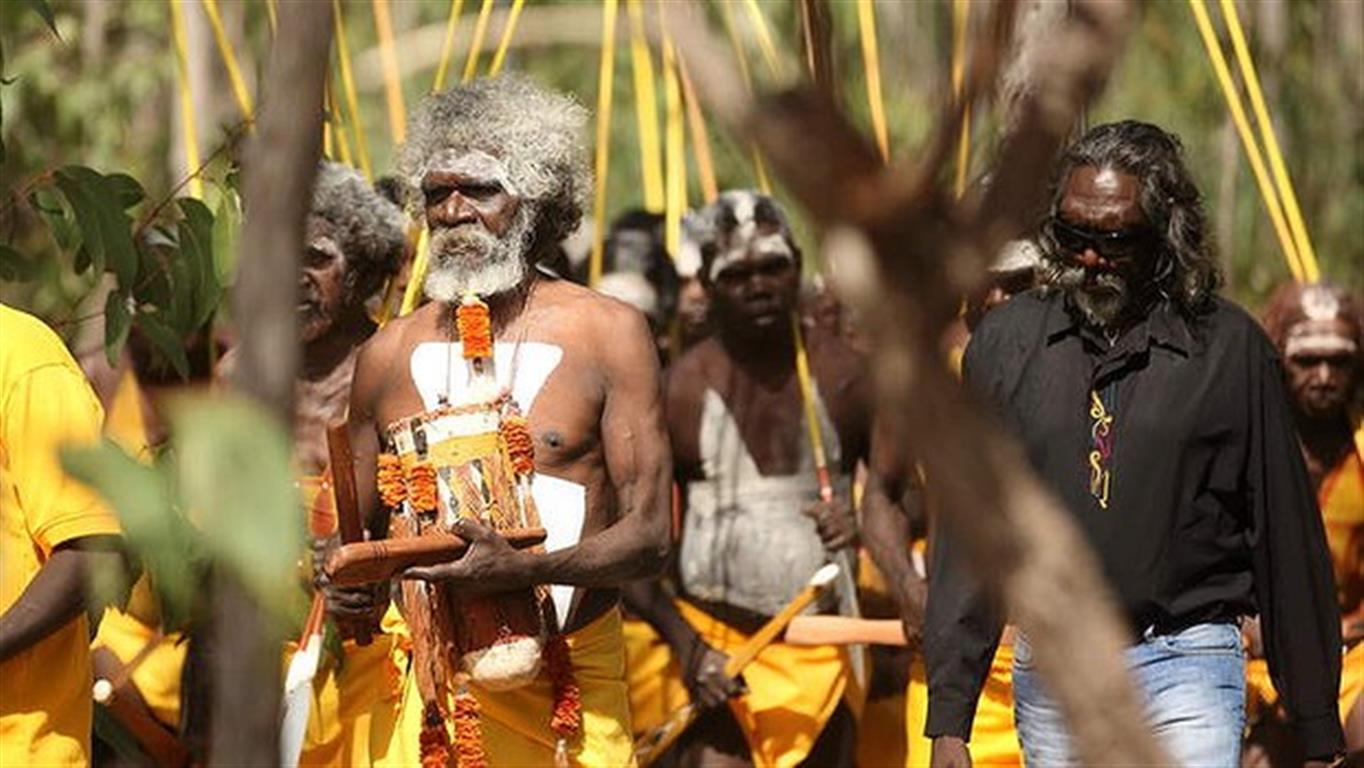 t Oil) and Paul Kelly. It was an incredibly emotional service that included several traditional dances by his clan and family members. We were really fortunate to be able to attend the service and It was a fascinating introduction to the Aboriginal culture.
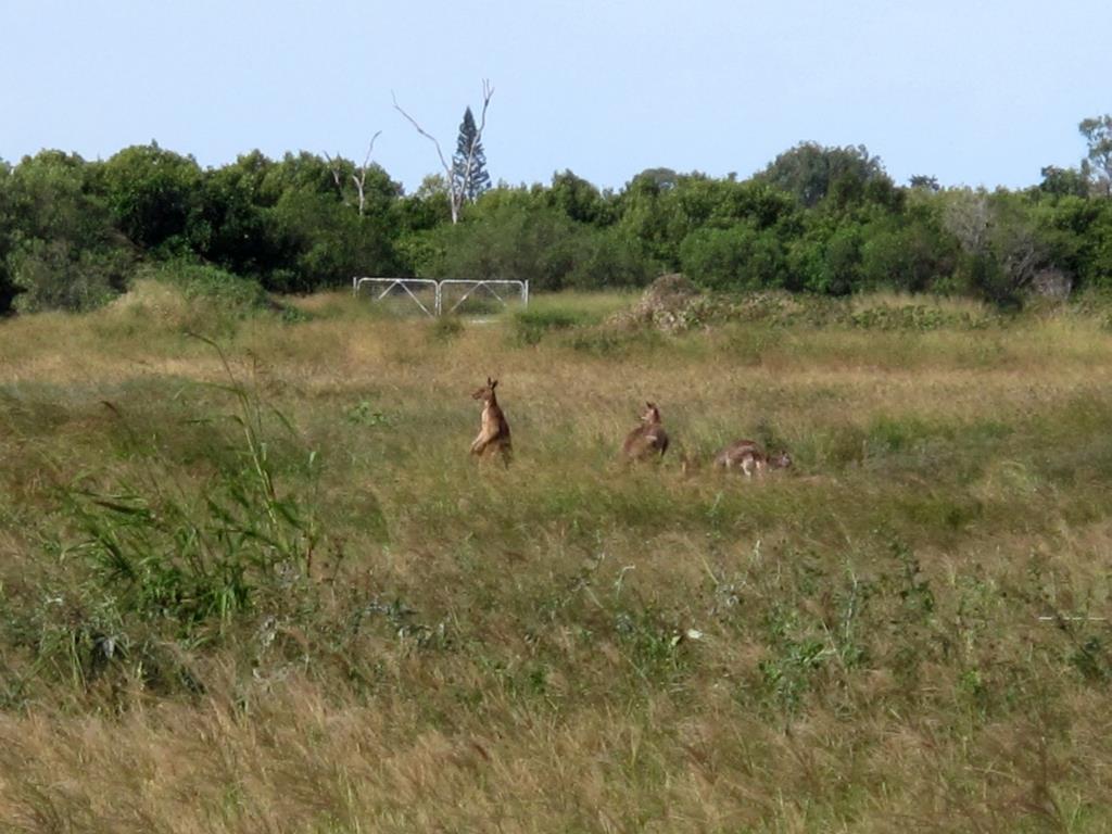
On another note, the Northern Territory is supposed to be loaded with saltwater crocodiles and we have been really hoping to see one…from a safe distance.. As we left Seisia, two boats saw a 10 foot croc swim right behind Hokule’a, but of course we were looking forward and didn’t see it. Maybe we will get to see one before we leave Gove…
~~~~~~~~~~~~~~~~~~~~  ~~~~~~~~~~
  ~~~~~~~~~~~~~~~~~~~~
Tuesday, June 25, 2013 – Seisia, Northern Territory, Australia
Ever since we have owned Hokule’a and Bill has owned Solstice, there has been this weird thing that sometimes happens. When something breaks or goes wrong on one boat the same thing usually happens to the other boat shortly thereafter. For example, on the trip from California to Mexico we both broke our stainless steel boom vang attachments within minutes of each other. I guess it’s probably not that weird since the boats are both Liberty’s and they are close to the same age. Usually it’s some type of mechanical or electrical failure, but this time it was a little different. More on that in a minute…
We left Lizard Island last Thursday and planned to do an easy overnighter to a place called Morris Island. (Our definition of an easy overnighter is when you can leave somewhere in the early afternoon and be at your next destination early the following morning. A long overnighter is when you leave somewhere at sunrise and try to get to your next destination before sunset the following day). The next morning when we arrived at Morris Island, we heard from a group of our friends on the radio net that they were headed to the next anchorage up the coast called Portland Rhodes. Evidently there was a small restaurant there and they suggested we try to get there to meet up with them for dinner at 6pm. The only problem was that it was already 10am and we were 60 miles from Portland Rhodes. That meant that we would have to average 7.5 knots (we normally average 6.5 knots) just to make there by 6pm. That did not include time to anchor, get the motor on the dingy, make it to shore, and find the restaurant. Jackie and I decided to go for it anyway, thinking that we probably wouldn’t make it in time for dinner, but that it would be really nice to catch up and be in the same anchorage with all of those guys. And just like that our easy overnighter turned into a long overnighter.
Over the next several hours the wind piped up to its normal (for this part of the Queensland coast) 25-30 knots and we enjoyed the protection of the Great Barrier Reef as we sailed along in flat seas at speeds of over 8 knots. Needless to say we arrived in time to have a wonderful dinner ashore with our friends on the boats Inspiration Lady, Norsa, Gerramar, Far Star and Kite.
The next morning, the 6 boats headed north on another easy overnighter (much to Jackie’s dismay) to round the northern most part of the Australian continent, Cape York. Sailing conditions were once again fantastic with 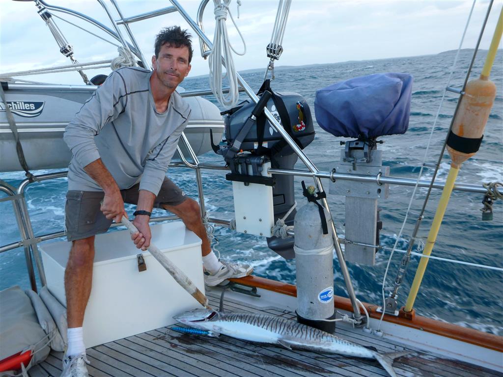 20-25 knots and flat seas. Along the way we caught a 4’ Walu (Spanish Mackeral) that filled the freezer with fresh fish. The shortest route for us to round Cape York was through a narrow channel called the Albany Pass. Currents flow thru Albany Pass at up to 6 knots so it is best to time your trip through either at slack tide (no current) or just as the tide is rising to ensure that the current is going with you. We timed it perfectly at slack low tide, made it through the pass and rounded Cape York by about 8am. Our plan, along with Kite and Far Star, was to duck in and anchor behind Cape York and then hike out to the tip of the Cape with a celebratory bottle of champagne. So we dropped the sails, started the engine and headed towards the anchorage.
As with most anchorages along the coast of Australia, we use local information published in cruising guides to find, enter and exit anchorages because our Raymarine/Navionics electronic charts lack sufficient detail to do so. For the anchorage at Cape York, the cruising guide says that the shifting sandbars at the entrance to the anchorage can be avoided by staying close to the small island north of Cape York. So we move as close to the island as we fe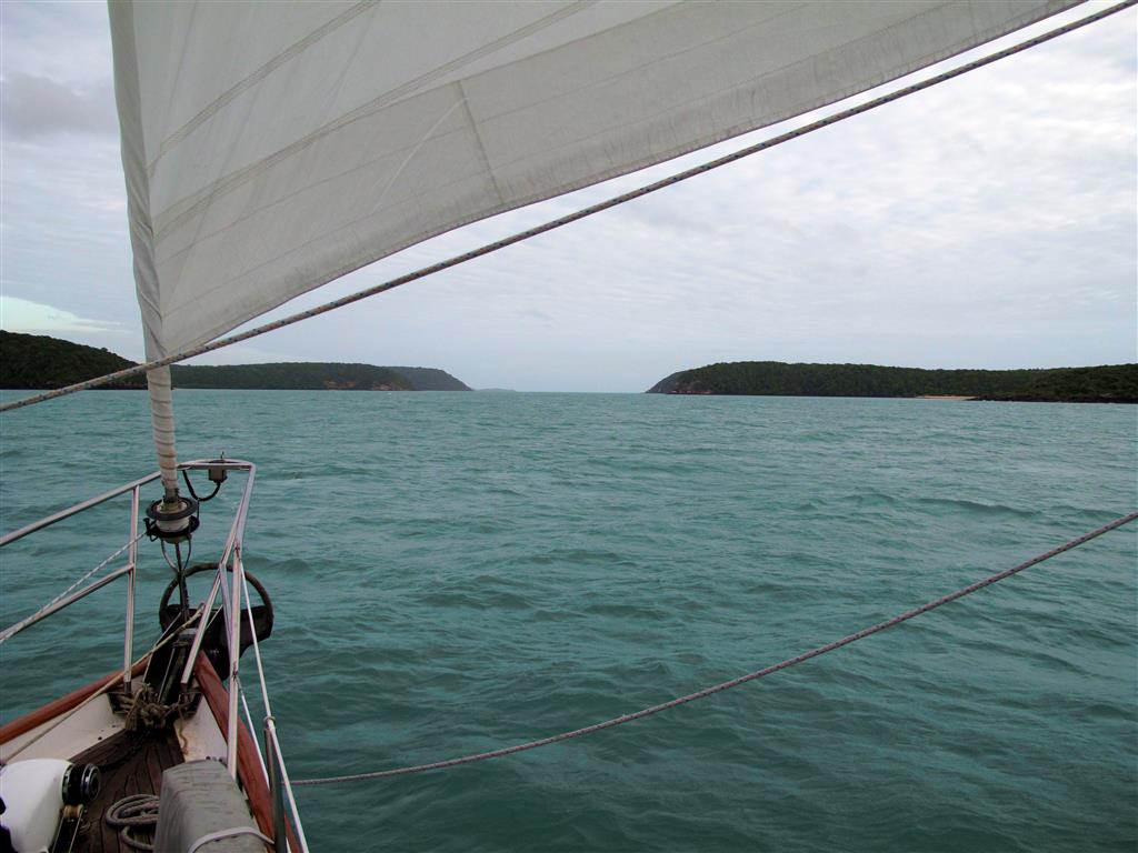 lt comfortable (considering we had 20 knots of wind and a 2 knot current) and headed in. It was low tide and from the information in the cruising guide we expected that the depth would drop to about 11 feet but not any shallower. As we approached the entrance, the depth meter flashed 16’, 15’,14’,13’,12’,11’ and then 10’ at which point both the depth alarm and Jackie started making loud high pitch noises. We started to turn away but the depth sounder continued 9’, 8’, 7’. The next few seconds were rather surreal as Hokule’a gently, yet abruptly, came to a stop and we came to the realization that we had just run aground. It was as if we had been riding a bicycle on a concrete path along the beach and then we ran off the path into the deep sand coming to a stop…gently, yet abruptly.
Jackie went in to action immediately shifting into reverse and giving it a lot of throttle. Slowly Hok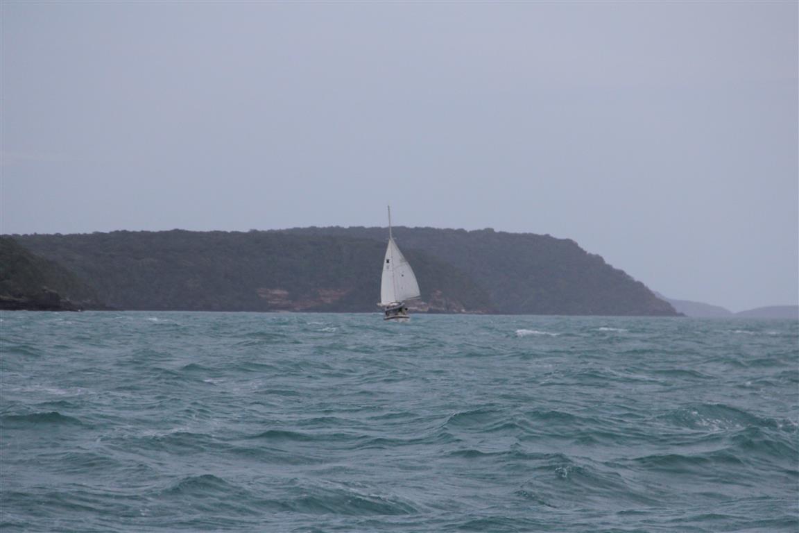 ule’a began to move backwards. We then put it in forward and tried to make a sharp turn to port to get back out to deeper water but Hokule’a would not respond. No matter how much throttle we gave it, she would not move. I ran down below to check the engine and saw that the prop shaft was not turning, meaning that the transmission was not working. I ran back up on deck to see if there was any way that we could start sailing, while Jackie radioed our friends on Kite (who were also approaching the anchorage) to let them know that not only had we run aground but now our transmission was not working. The wind was blowing us back towards the sand bar which made trying to sail away from it nearly impossible, so I ran back down below and started trouble shooting the tranny. Pretty quickly I found that the shifter cable had separated from the transmission and fortunately I was able to jury rig it back in place with some seizing wire. Jackie then put Hokule’a in forward and motored out to deeper water where we followed Kite to the anchorage at Seisia about 15 miles away. Even though it felt like a life time, we on and off the sandbar in about 5 minutes.
Jackie and I were both pretty shaken up about running aground for the first time ever. Over the past 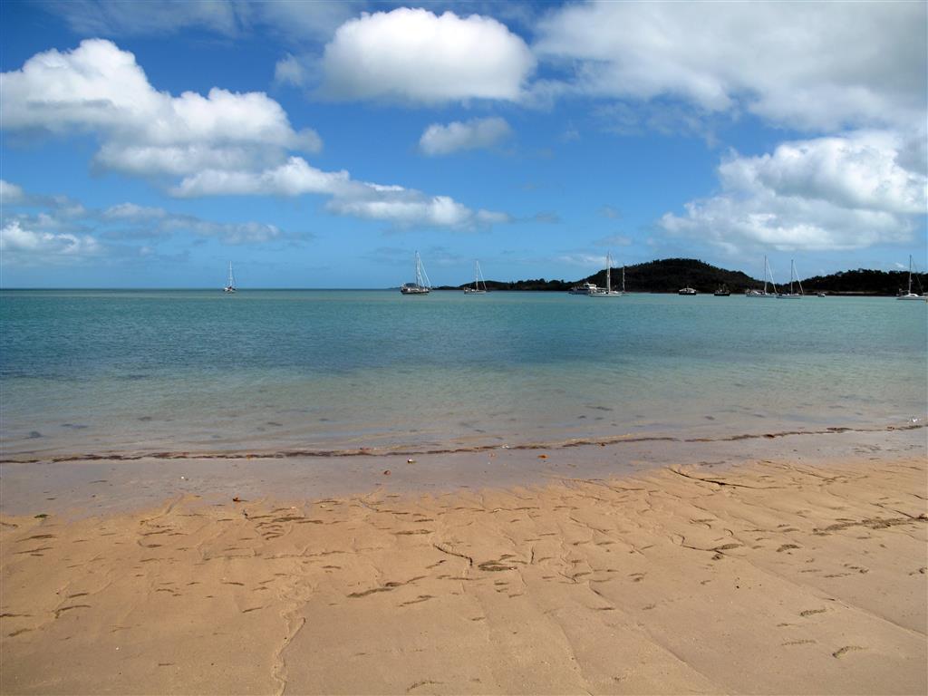 20 some years, I have owned 5 different sailboats, sailed thousands of miles, and not once have I ever run aground on one of my boats. How could this have possibly happened? We even made it through the notoriously shallow Broadwater and Sandy Straits without touching bottom. We felt a little better hearing that two boats behind us also “bumped the bottom” trying to get into the anchorage and the only advice we can give to anyone wanting to go there is to not go in at low tide (wait for mid-tide or higher) and get really close to the island. There is a saying in the cruising community that “There are 2 types of cruisers. Those who have run aground and those who lie about it.” Apparently all of our cruising friends have run aground at some point and they were shocked to hear that we had never been aground before. There is another saying in the cruising community that “You haven’t truly been cruising until you’ve run aground.” Well I am not happy about it, but I guess we can officially say that we have been cruising now.
So back to the thing between Hokule’a and Solstice where something breaks or goes wrong on one boat and the same thing usually happens to the other boat shortly thereafter. Guess what happened to Bill and Solstice for the first time ever about a week ago…… I should have known.
Wednesday, June 19, 2013 – Lizard Island, Great Barrier Reef, 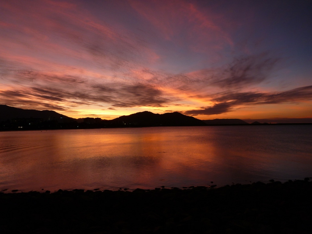 Australia
From Hinchinbrook we did an overnighter to the city of Cairns. Fortunately, Jackie has become a little more tolerant of the overnighters here recently because the sailing conditions inside the Great Barrier Reef have been pretty amazing. Strong winds (25-30 knots) and relatively flat seas have made for some fast and comfortable trips.
It was rather surreal to go from the extreme remoteness of Hinchinbrook to being in a relatively large 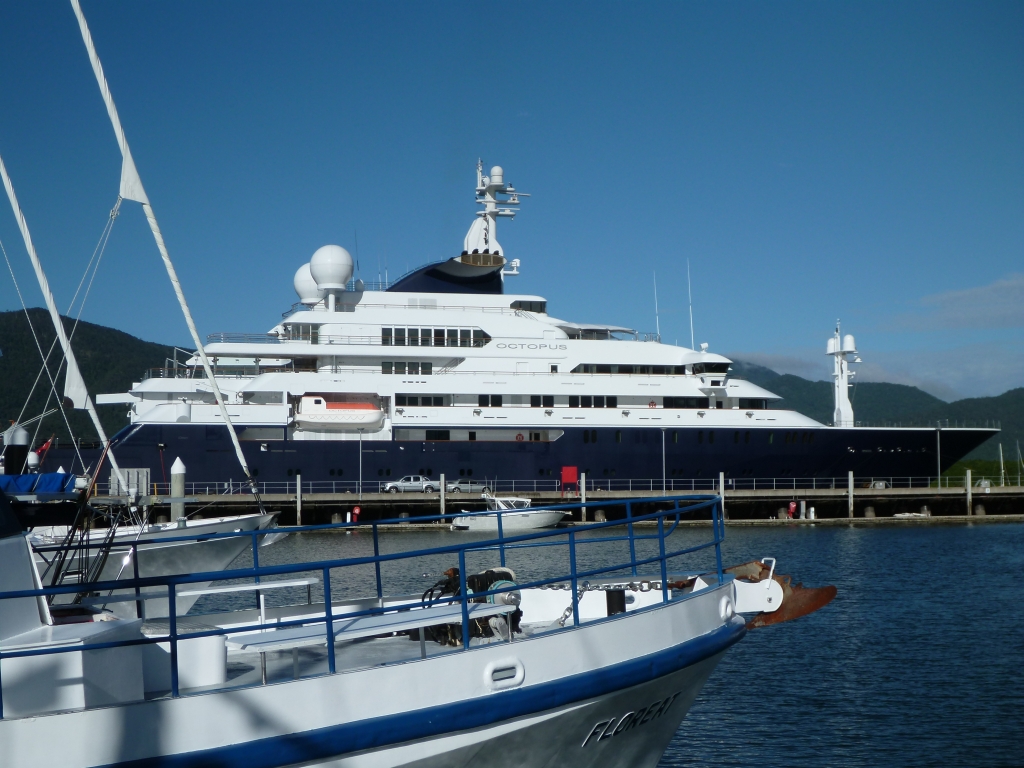 city in less than 24 hours. To add to the shock factor, Paul Allen’s 414 foot mega yacht Octopus was at the end of our dock when we pulled into the Cairns marina. Cairns is the last large city until we get to Darwin, so we spent a few days there provisioning and enjoying the conveniences of civilization such as showers, laundry, restaurants, and of course, ice cream.
On Monday we did yet another overnighter, this time from Cairns to Lizard Island. North of Cairns the Gr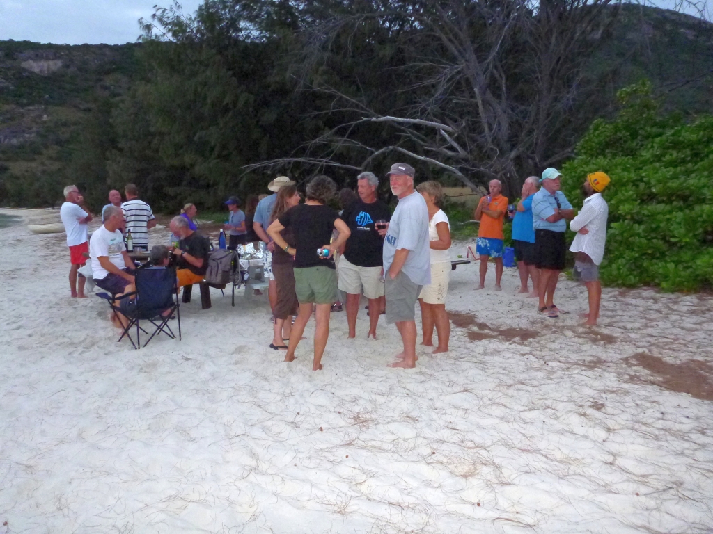 eat Barrier Reef starts to get really close to the mainland and makes navigation a bit more challenging. Captain Cook even noted in his logbook about this area that he was “altogether at a loss as to which way to steer”. Cook went to Lizard Island (actually he named it Lizard Island because the only animals he saw ashore were Goannas) and climbed up to the highest peak to try to sight a way out of the “labyrinth” of reefs and escape to the open ocean. From that peak he saw a narrow gap in the reef which is now known as Cook’s Passage. We hiked up to the same peak where Captain Cook stood, took one look at how roug
 h it was outside of the reef and decided that we were much happier inside the reef.
Lizard has certainly been one of our favorite stops. The water here is reminiscent of the South Pacific being crystal clear and alive. Shortly after dropping the anchor in Watson’s Bay, five small black tip reef sharks swam up to Hokule’a to say hello. The coral is in pretty good shape and there are some of the largest giant clams here that I have ever seen. I have been spending lots of time in the water because L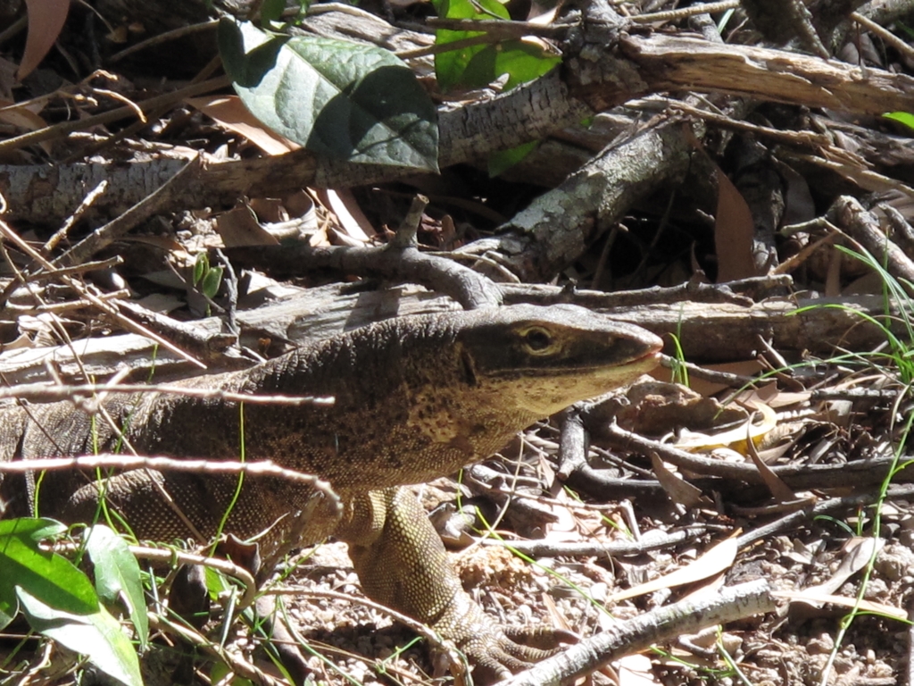 izard is apparently the last place that we can safely get in the water because of the increased presence of salt water crocodiles further north. We also caught up with a lot of our cruising friends here and we had a big potluck on the beach last night.
The weather for sailing north continues to be perfect, so we are having a hard time trying to find a balance between hanging out in places we really like and making 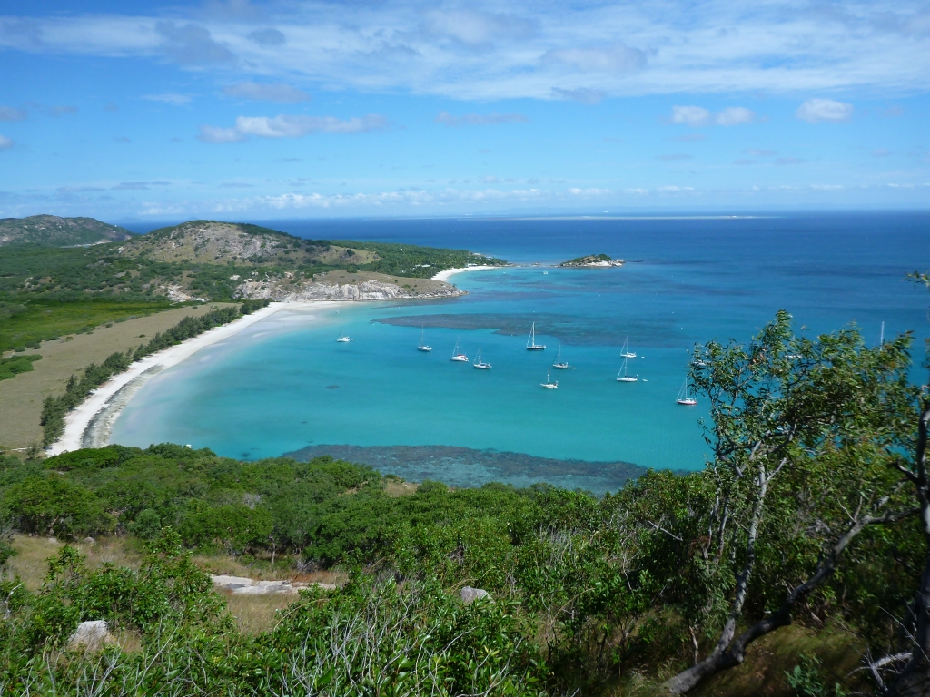 progress towards Darwin while the weather is good. Looks like we will be leaving Lizard way too soon
Wednesday, June 12, 2013 – Haycock Island, Hinchinbrook Channel, Australi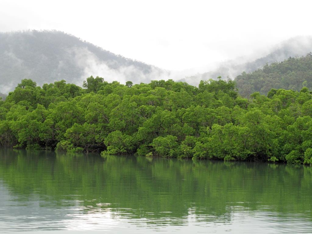 a
a
Our trek north up the east coast of Australia continues. As you probably remember, we left Sydney in early April, giving ourselves 3 months to travel the 2700 miles to Darwin. Well, it’s now early June and we are only half way there. One month left to cover 1300 miles.
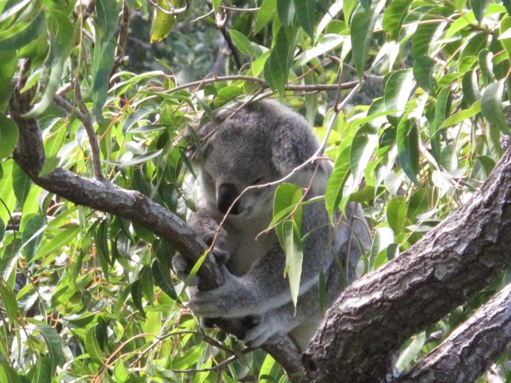
We left the Whitsundays about a week ago and sailed up the Whitsunday Passage on an overnighter to Magnetic Island. Captain Cook made this same trip on June 4th, 1770 and gave Magnetic Island its name because he thought the island was responsible for the magnetic interference that he was experiencing on his compass. Today 2/3 of the island is National Park and its home to northern Australia’s largest colony of koalas. We spent 3 wonderful days in Horseshoe Bay relaxing, hiking, swimming, looking for koalas, and simply enjoying being in one place for a bit.
We then did day hops to Orpheus Island and then to the Hinchinbrook Channel where we are today. The 26  mile long Hinchinbrook Channel is considered the most scenic waterway on the entire east coast of Australia and I could not agree more. It’s formed by Hinchinbrook Island with its spectacular peaks on the east and the mountainous Australian mainland to the west. Hinchinbrook Island is the largest island on the Great Barrier Reef and to no surprise it is a national park. If you took away the mangroves, you would swear that you were on a river in the middle of the Blue Ridge Mountains in Virginia. The crazy thing is that we are the only boat here.
We would love to stay here for a while, but as I mentioned we still have a long way to go to Darwin…
~~~~~  ~~~~~
~~~~~  ~~~~~
~~~~~  ~~~~~
~~~~~  ~~~~~
~~~~~
Wednesday, June 5, 2013 – Hamilton Island, Whitsundays, Australia
And just like that, John’s visit and our 10 day cruise through the Whitsunday Islands are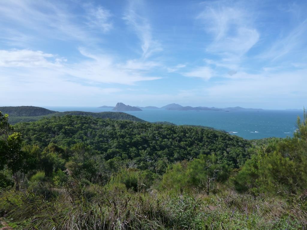 over as John fly’s out in just a few hours from here at Hamilton Island. When John comes to visit we let him plan the itinerary, which is a really nice change of pace considering all we have to do is pick up the radio, call Solstice and ask John where we are headed that particular day. John always does his homework and it was a great itinerary. The only challenge was the weather (as usual) as we had 20-25 knot winds for most of the time.
After he arrived we spent a day in Airlie Beach and then headed over to Nara Inlet on Hook Islan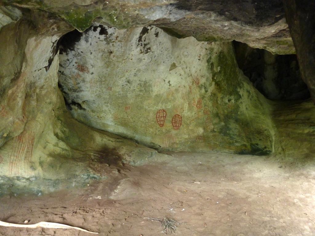 d. Nara Inlet was once home to an aboriginal tribe called the Ngaro . The Ngaro people left the mainland over 9000 years ago and settled in the Whitsunday Islands. Near the end of Nara Inlet is an ancient cave dwelling with cave paintings that are over 2300 years old.
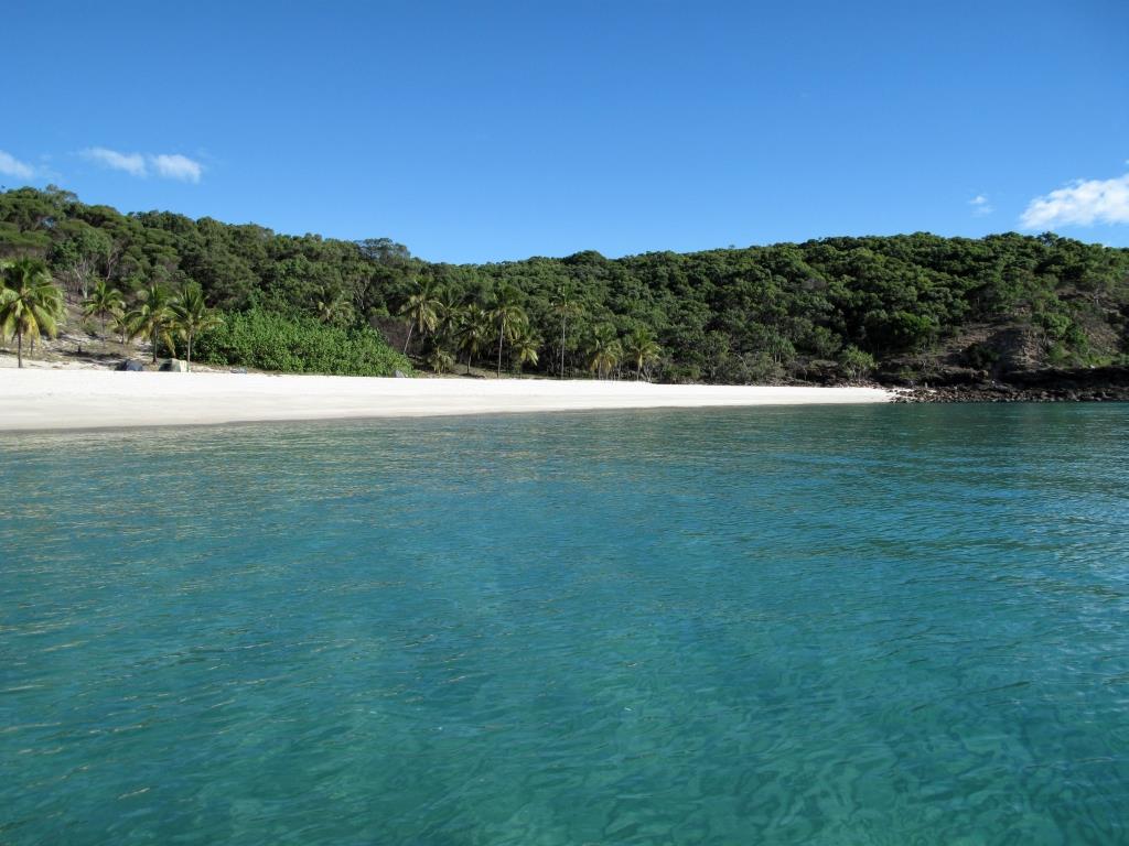
Over the next several days we headed north to Blue Pearl Bay on Hayman Island , then south to the east side of Hook Island at Butterfly Bay, then on to Cateran Bay on Border Island, to Whiteha ven Beach on Whitsunday Island, and finishing the trip off here in Hamilton Island. I have to say that Whitehaven Beach was probably my favorite spot and I guess that I am not alone in that determination as Whitehaven is consistently rated as one of the top 10 beaches in the world. It’s nearly 5 miles long and has some of the whitest sand I have ever seen. The combination of the blue water, the white beach and the green tropical vegetation is visually stunning. At Whitehaven, Jackie, John, Bill and I set off on a hike to a place called Chance Bay. Shortly after getting off the beach and into the bush we saw a
  4 foot long Goanna (monitor lizard). Jackie wasn’t very keen on hiking after that and when the trail got a little less defined she opted to head back to the beach. Probably a good call on her part because after that we saw another goanna, several large and very scary looking spiders, and to top it off I nearly stepped on a snake. But Chance Bay was worth the effort and later that evening we all watched the sunset over Whitehaven Beach with dinner and drinks in the cockpit of Hokule’a. Hamilton Island has been a treat also, with a great resort, swimming pools, great beaches ,hiking trails, and the famous Hamilton Island Yacht Club. Needless to say we are sad to see John leave.
When John heads to the airport, we are off to Cid Harbour on Whitsunday Island to meet up with fr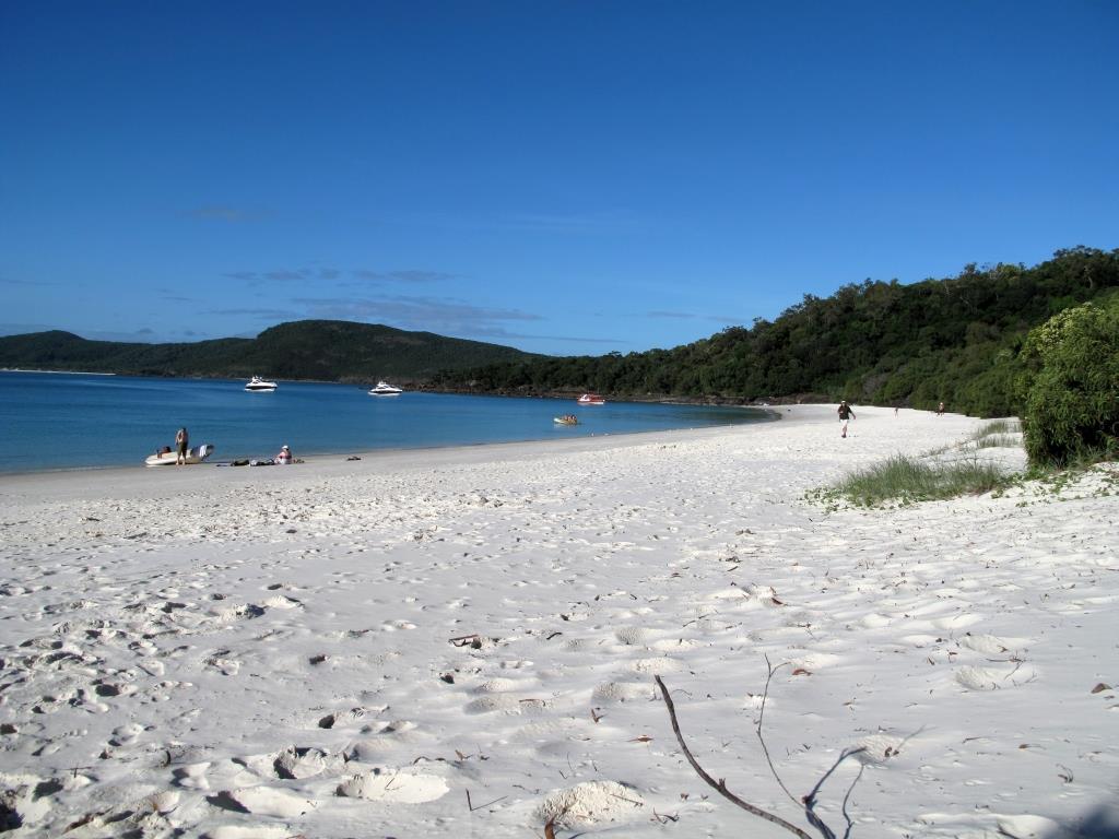 iends on the boat Elizabeth Jane II and explore a little more of the Whitsundays. Solstice is headed back to Whitehaven to unwind from what has been a very fun 10 days. Can’t wait until your next visit Johnboy…
Saturday, May 25, 2013 – Shaw Island, Whitsundays, Australia
Once again the weather has thrown a slight monkey wrench in to our plans. We had hoped to hang out at Shaw Island for a few days and then head to Hamilton Island (about 10 miles away) to meet John when he arrives on Monday. Unfortunately the Aussie weather guys are forecasting 25-30 knots of winds for the next several days. Typically when they forecast 25-30 knots of wind it ends up being more like 30-35 knots. The weather guys actually issue a disclaimer after every forecast saying “Winds can be a further 40% stronger that the averages given here and waves can be twice the height.” This disclaimer is now required because of inaccurate weather forecasts given during the infamous 1998 Sydney to Hobart race where 6 sailors and 5 boats were lost at sea.
We didn’t really like the idea of trying to get Hokule’a into a very small berth next to very expensive boats in the very fancy Hamilton Island marina in 30+ knots of wind. So we were chatting on the morning radio net with our friends on the boat Kite, who suggested that we head to Airlie Beach (about 30 miles away) where they and another friend of ours on the boat Far Star were waiting out the weather. What a great idea! We hadn’t seen Kite or Far Star in over 5 months and it would give us a chance to catch up with them while John could easily get a ferry from Hamilton Island to Airlie Beach. So we are waiting for the tide turn at about 9:30 this morning and then we will set sail for Airlie Beach. Solstice is sailing up from Mackay and changing course to Airlie Beach also. Sounds like a party…
Friday, May 24, 2013 – Shaw Island, Whitsundays, Australia
We left Mackay this morning after spending the past 4 days in Mackay Marina waiting for  better weather and doing a bit of re-provisioning. Not much else to do here so we are anxious to get going. The tides here in Mackay are some of the largest on the entire east coast of Australia and the water level can change by over 20 feet between low and high tide. Needless to say the pilings in the marina have to be pretty tall.
As we were leaving the marina we pulled into the fuel dock to top up on diesel and by the time we were done Solstice pulled into the fuel dock having just arrived on an over-nighter from Island Head Creek. We said some quick hi’s and goodbye’s and headed out knowing that we would rendezvous in the next few days when John arrived from the States.
Jackie and I had planned to island hop our way up to Hamilton Island where John would be flying in on Monday. Our first stop was Brampton Island about 22 miles north of Mackay. When we arrived at Brampton Island around 1pm, we found that the anchorage had 2-3 foot white capped waves rolling through it. The weather forecasters were once again completely off on the forecast as the wind was blowing out of the west and not the southeast as forecas ted. So we headed for Goldsmith Island about 12 miles away hoping that it would have some protection from the west, however we found conditions in that anchorage to be the same. It was now 3pm and our last shot at getting to an anchorage before dark was another 12 miles north at Shaw Island.
As we approached Shaw we could see 15 or more boats in the anchorage, which in this case was a good sign. We have just got the anchor down, the sun is starting to set, and although it’s blowing 25+ knots it’s pretty darned comfortable. Can’t tell you how happy we are to be here and that we are not faced with spending a potentially miserable night at sea. To add to our bliss, a beautiful full moon just rose over the island.
Monday, May 20, 2013 – half way from Curlew Island to Mackay, Australia
The past week has been nothing short of awesome. Right now we are sailing towards Mackay on one of t hose rare perfect sailing days. Bill on Solstice and I refer to a day like today as a “guitar playing day” because it’s sunny and warm, with calm seas and 10-15 knots of wind, sailing along at 6.5 knots in the right direction, and it would be an ideal time to get out the guitar and play up on the foredeck. Obviously, I am not up on the foredeck right now, in fact since leaving California we have maybe had a dozen “guitar playing days” and I don’t think that I have ever gotten the guitar out. My excuse today is that I would instead take the opportunity to write a quick update.
A week ago we left Bundaberg and headed 57 miles offshore to Lady Musgrave Island (see the satellite view on the Where’s Hokule’a Page for our position on 5/13/2013). The island is located inside of a coral atoll at the southern end of the Great Barrier Reef and there is a pass on the northwest side of the atoll that provides access inside the lagoon. We have had a number of exciting trips through various passes into coral atolls before, but this time co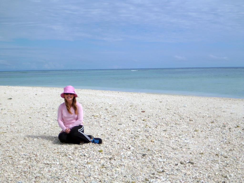 nditions were absolutely perfect. Check out the attached video to see what it’s like to enter a coral atoll in perfect conditions. After entering the pass we wove our way around a few coral heads and over towards the island. It was so nice to be back in crystal clear water and to watch the anchor hit bottom with a puff of white sand some 30 feet below the surface. The reef is part of the Great Barrier Reef World Heritage Area and the island is a national park, so we did a bit of hiking, snorkeling, turtle watching, and exploring different parts of the reef in the dingy. After 2 glorious days there, we were off again racing the weather and trying to get to a protected anchorage in Island Head Creek about 150 miles further north. On the way we crossed over the Tropic of Capricorn which meant that we were officially back in the Tropics.
The entrance into Island Head Creek has a number of unmarked shallow spots and thankfully our friends on the sailboat Kite gave us their waypoints for entering the creek. Normally we would use Google Earth to help us get i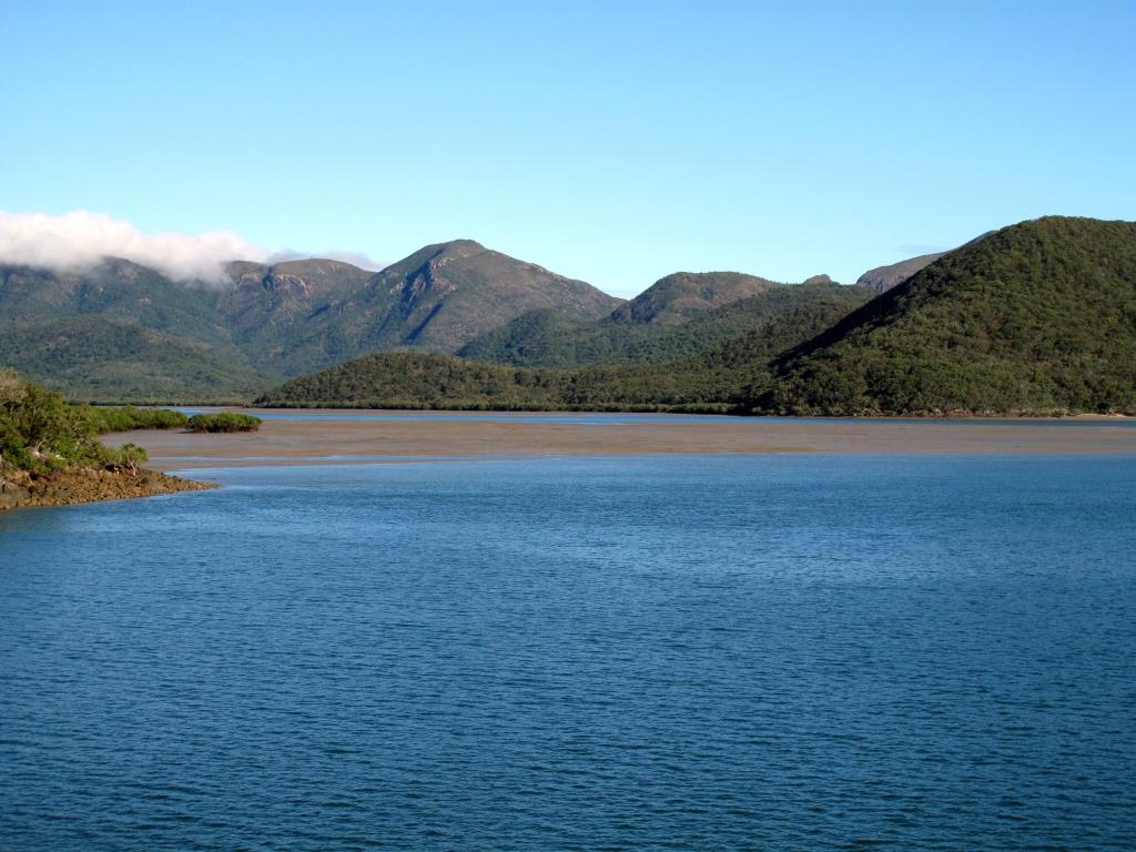 n sketchy spots like Island Head Creek, but the google images were pretty bad in this case. Thanks again Kite! Shortly after entering the creek and getting the anchor set, the frontal system hit and we had zero visibility in the wind and rain. It was a wild night, but fortunately the anchorage is very protected from all wind directions. We woke up the next morning to sunshine and a beautifully wooded landscape and we really struggled with whether to leave or stay another day. The unanticipated delay in leaving Bundaberg had really put a dent into our schedule as we needed to be in the Whitsundays by May 27th to meet our friend John. Ultimately, it was just too darn pretty to leave, so we stayed another day figuring that we could make the time up somewhere down the road.
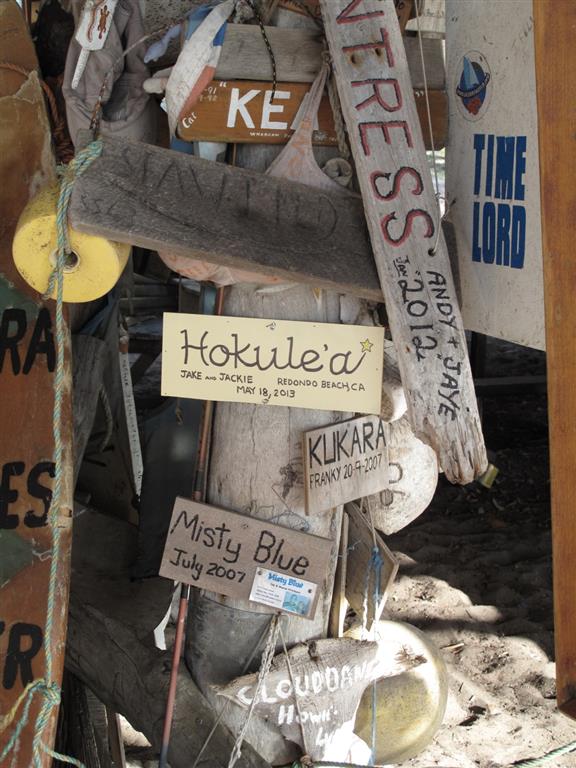
Our next stop was a daytime sail to West Bay on Middle Percy Island only 56 miles north of Island Head Creek. While it was a good sail, it didn’t qualify as a “guitar playing day” because we had to motor for a while. West Bay is famous for its A-frame hut where cruisers hang out for “four-sees” (happy hour) and where cruisers over the past 50 years have hung signs with their boat names and crew. Of course Hokule’a now has a sign in the A-frame too. The island is beautiful with great hiking trails, a huge white sand beach, and crystal clear water. In addition there were thousands of butterflies flying around in the anchorage and all over the island. It was rather surreal to be sitting on deck that night in the moonlight with butterflies fluttering about. In the morning, we were once again faced with the dilemma of whether we could stay longer or not. We figured we could stay another day, but then we would have to do an over-nighter to Mackay to get in before the next weather system. Jackie really hates over-nighters, so we came up with a compromise where we would hang out in West Bay until early afternoon, then sail 26 miles to Curlew Island where we could anchor for the night and still make it to Mackay the next day. Life is all about compromise and thanks to compromise we are enjoying another “guitar playing day”. Maybe one of these days I will actually get the guitar out…
~~~~~~~~~~  ~~~~~~~~~~
  ~~~~~~~~~~
  ~~~~~~~~~~
Friday, May 10, 2013 – Bundaberg, Australia
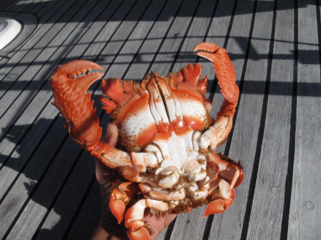
It’s hard to believe that we have been in Bundaberg a week already waiting for a good weather window to get out to the southern end of the Great Barrier Reef. Granted it’s been a good week, taking care of a few boat projects, bike riding along the coast through the town of Bargara and the Mon Repos turtle sanctuary, eating spanner crabs and watching the kangaroos, but we had really hoped that this would be a quick pit stop simply to refuel, re-provision, and let Bill catch up. We celebrated Solstice’s arrival on Wednesday with traditional Bundaberg drinks called Dark-n-Stormy’s. but unfortunately on the way here Bill discovered a hydraulic steering leak. The good news was that he could get it fixed in Bundaberg, but the bad news was that it would take another 4 or 5 days. So with an ideal weather window approaching later this weekend, it looks like once again we may be heading out and looking to meet up with Solstice somewhere further north.
~~~~  ~~~~
~~~~  ~~~~
~~~~  ~~~~
~~~~  ~~~~
~~~~
Wednesday, May 1, 2013 – Kingfisher Bay, Fraser Island, Australia
It’s a little after 4pm and we just dropped anchor in Kingfisher Bay at the northern end of the Great Sandy Strait. The past two days have been pretty exciting with major adrenaline rushes during the day followed by beautiful and tranquil anchorages in evenings. More on that in a minute.
We left Coffs Harbour a little over a week ago and had a really great 2 day sail up to Mooloolab a. With the exception of a few hours of fluky winds and the ever present East Australian Current, we had near perfect sailing conditions with southeasterly winds at 10-15 knots and a full moon at night. The sun was just starting to rise as we slowly weaved our way through all of the anchored cargo ships that sit south of Mooloolaba waiting for clearance into Brisabane. Our timing into Mooloolaba was perfect as we arrived outside harbor almost exactly at high tide.
Mooloolaba is the first place that we have re-visited with the boat since we have been in A ustralia. We enjoyed it so much the first time that we just had to come back. Going for a run on the beach, then swimming in the Coral Sea, followed by a white chocolate mocha frappucino from Starbucks….does life get any better? We certainly could have hungout in Mooloolaba for a while, but the tides and the weather were starting to line up for an opportunity to do something that we didn’t get to do on our way down the coast, Fraser Island via the Great Sandy Strait. Fraser Island is a World Heritage Site and it’s the largest sand island in the world. Ecologically speaking it is an amazing combination of giant sand dunes, tropical rain forests, crystal clear streams, elevated fresh water lakes and marshlands. The Great Sandy Strait is a shallow estuary that winds its way between Fraser Island and the Australian mainland. The island and the strait are home to an unbelievable array of animals including eagles, dingos, dugongs, sea turtles, dolphins, and even crocodiles.
One of the challenges in transiting the straits is the shallow depths that require boats such as Solstice and Hokule’a (we draw 6.5 feet) to “work the tides”. Working the tides simply means that we have to travel across th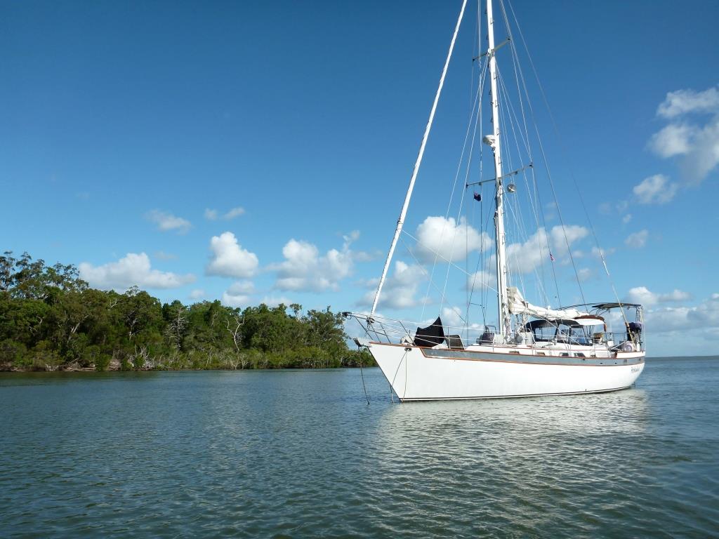 e shallow spots at high tide, find a deep spot to anchor, and then wait for the next high tide to get across the remaining shallow spots. Very similar to what we had to do to transit the Broadwater last November. The other challenge is having to get across the Wide Bay Bar to simply enter the Great Sandy Strait. So in order for us to visit Fraser Island and transit the Great Sandy Straits we needed the perfect combination of good weather, moderate wind, a small swell, and a high tide in the middle of the day. The good news for us was that a window was opening up if we left Mooloolaba on Monday night, the bad news was that the window would close quickly because of the tides, an increasing swell and a strong southerly forecast for later in the week.
We planned to leave at 10pm on Monday, which would get us out of Mooloolaba close to high tide and give us plenty of time to get to Wide Bay Bar (about 50 miles away) several hours before high tide the next morning. The weather forecast was for 10-15 knots of wind out of the southeast. Things seemed to be lining up perfectly.
Jackie and I had Hokule’a ready to go by noon on Monday and planned to take it easy in the afternoon with an early dinner and a nap before we headed out. During dinner we got a call from Bill saying that he had a problem with his engine. I helped him trouble shoot it over the phone and we figured out that his oil/tranny cooler had failed allowing saltwater into his engine. I left dinner and helped him get started on the repair. It’s an easy fix if you have a spare oil/tranny cooler and a few extra gallons of oil onboard. He had a spare, but unfortunately it was an old one that the previous owner had replaced. Rightfully so, Bill decided that he should order and install a new one.
What a bummer! The silver lining is that it couldn’t have happened in a better place… in a slip in a safe marina and not while trying to cross Wide Bay Bar. I went back to dinner where Jackie and I struggled with whether we should leave or not. The reality was that there was nothing that we could do except wait around for the new part to arrive. I kept trying to convince myself that it was OK to leave without him because we weren’t leaving him at sea or in some sketchy anchorage without an engine. It was after all Mooloolaba, but it still didn’t feel right. Ultimately, Bill convinced me that it was OK to head out and I told him that we would see him in Bundaberg.
At 10:30pm, Bill helped us cast off our dock lines and we headed out of the harbor. After a few hours, our forecasted 10-15 knot southeasterly wind turned into 15-20 knots out of the east and then a few hours later to 20-25 knots out of the northeast. The seas quickly built up to 2.5 meters (8 feet) and our forecasted perfect sail had turned completely miserable. For the first time in nearly 2 years, Jackie actually needed the bucket for her seasickness. We pressed on and arrived outside of Wide Bay Bar around 8:30am well before our planned bar crossing time of 10:00am. Apparently, the trick with crossing bars is that you don’t go in right at high tide, instead you cross an hour or two before high tide to ensure that you have current going with you and flowing into the river. This current helps to minimize the number of breaking waves on the bar. High tide was at 11:30am.
Jackie and I were both pretty nervous about crossing the bar. While we had crossed several smaller bars between here and Sydney, this one we felt was a “real” bar. The bars that we had crossed previously were narrow and you could get across them and into safe water in 5 to 10 minutes. Wide Bay Bar as the name implies is wide and it would take us approximately 45 minutes to get across. Wide Bay Bar’s notorious reputation didn’t help our nervousness, nor did all of news reports as we were leaving Mooloolaba about “Wide Bay Bar claims yet another vessel”. Apparently a 40-something foot power boat tried to cross the bar yesterday in the wrong location and was destroyed. The last thing we heard before we left was that they were still searching for the three people on board. All night long the Coast Guard was issuing warnings on the VHF radio to all mariners in the vicinity of Wide Bay Bar to be on the lookout for partially submerged debris from the wrecked vessel.
The coast guard has a station near the bar in Tin Can Bay, so we called them on the radio to request a report for conditions on the bar and to confirm the latest GPS waypoints for crossing it. A very pleasant gentleman responded, confirmed our way points and said that he didn’t have a bar report as no one had crossed the bar yet that morning. I told him what conditions were like outside of the bar (sustained 25 knots out of the east with higher gusts and 2.5 to 3 meter (8 to 10 foot) seas) hoping that he would say either a)we don’t recommend crossing the bar in those conditions or b) you should be fine crossing the bar in those conditions. Instead we got more questions. How big is your vessel? Are you a sailboat or a powerboat? Do you have experience with handling your vessel in large breaking seas? What is your radio call sign? After responding to all of his questions he said to call him back when we got to the first waypoint and then again when we got to the third waypoint.
At this point we still had about an hour to kill before we began to cross, so we sailed back and forth more or less parallel to the bar. Conditions outside the bar were getting worse and constantly staring at the mass of breaking waves on the bar was not making us feel any better about crossing it. At about 9:30am, I told Jackie that I was a little scared to do this, but that I had total confidence in her and the boat, and that we should go now if we were going go. She agreed, so I turned the boat towards waypoint 1 and called the Coast Guard. He emphasized that we “must stay on the waypoints and whatever you do don’t cut the corner at waypoint 2”. He reminded us again to call him back at waypoint 3 and went on to say that if he didn’t hear back from us within 45 minutes they would start looking for us. To top it off he ended the call with “Good luck Mate!”
It was a complete leap of faith to head from waypoint 1 to waypoint 2 as all I could see was a solid line of breaking waves and whitewater ahead. Jackie just stared at the chart plotter and would tell me which way to steer to stay on course to the waypoint. After a few minutes, I could see that there was a tiny area directly ahead of us where the waves were only breaking occasionally. The waves were coming from directly behind us and about every fifth or sixth wave would be a 3 meter one that would lift the stern of Hokule’a up and threaten to send her surfing down into the trough. As long as I could keep Hokule’a from surfing, the waves would just lift her up and crumble underneath her. The danger in surfing was that she would likely round up (turn perpendicular to the wave) in the trough and the wave would break directly on her beam. It would also likely get us off course and into the really steep waves that were breaking on either side of us. Jackie still refused to look at anything other than the chart plotter and occasionally straight ahead. The 20 minutes it took us to get from waypoint 1 to waypoint 2 to felt like an eternity but I was getting really comfortable dealing with the bigger waves. As we approached waypoint 2 I could see massive waves just off of our port side breaking as if they were on a beach and now fully understood why the Coastguard said not to cut the corner. I told Jackie that she had to take a look at those waves, but she refused and just yelled at me to pay attention. At waypoint 2 we made a 45 degree turn to port which made the motion of the boat a bit more uncomfortable, but we had fewer big waves to deal with because we were getting some protection from the sandbar. Twenty minutes later at waypoint 3 we were across the bar and in the flat waters of the Great Sandy Strait. We called the Coastguard to let them know that we had made it to waypoint 3, gave them a conditions report and thanked them for their help.
We continued on up the Strait about 14 miles to an amazingly calm and beautiful anchorage off of Fraser Island called Garry’s Anchorage, where we planned to spend the night and wait for high tide the next day to cross over the really shallow portions of the Strait. On our way to Garry’s, we heard a boat call the Coast Guard to ask how the bar was and if they had any advice on whether it was safe to cross. The Coast Guard responded saying that they usually go by what they call the “15 by 15 rule”. He went on to explain that if the wind is stronger that 15 knots and if the seas or swells are bigger that 1.5 meters then it’s a no go. SERIOUSLY??? Did he really just say that? We are so glad that he didn’t say that to us, because we would be getting the crap beaten out of us right now trying to sail around outside of Fraser Island enroute to Bundaberg. All in all conditions on the Wide Bay Bar were much better than we had expected considering how bad conditions were outside of the bar.
We had a great night sleep at Garry’s and a lazy morning since high tide wasn’t until nearly 2pm. From 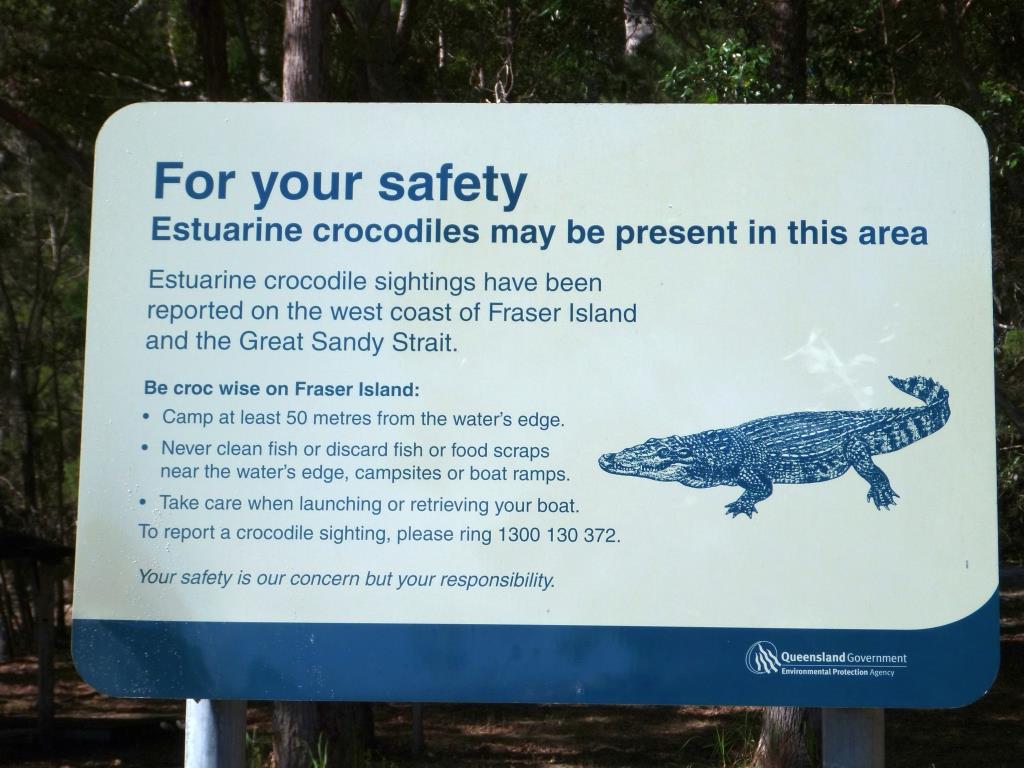 Garry’s we only needed to travel about 7 miles to get through the shallowest parts of the Straits. The trick here is to make sure you get through the shallowest part before high tide, so that if you do get stuck, you still have a rising tide to free yourself. The trip through was a bit nerve wracking because several of the navigational makers were missing and a few of them had been moved. But we found it to be less challenging than the Broadwater because it was deeper. The shallowest depth we saw was 10 feet.
So tonight we are anchored in another beautiful and calm spot off of Fraser Island called Kingfisher Bay. We would love to stay here a few days but as luck would have it, there is a weather system coming in late tomorrow afternoon. Looks like we will be racing to Bundaberg tomorrow to try to get in before it hits.
Monday, April 22, 2013 – Coffs Harbour, Australia
In the past 2 weeks we have only been able to get 255 miles further north. After leaving Pittwater we did a day trip up to Newcastle where we waited a week for northerly winds to switch around to the south. When they finally did, we did an overnighter up to Coffs Harbour where we waited nearly another week for strong southerly winds to die down. It’s a bit frustrating, but that’s just what it takes sometimes to get up the New South Wales coast. In addition to unreliable winds, we also have to deal with the East Australia current. That wonderful current that helped us get to Sydney so quickly is now fighting us. We have been sailing really close to the coast which seems to have reduced the current from 3-4 knots down to 1-2 knots.
Pulling into Newcastle, we passed dozens of cargo ships anchored outside of the harbor and we full y expected it to be a very dirty and industrial harbor based on the fact that it is the largest coal exporting port in world. But to our surprise it has a really great marina and a nice town with great beaches, really good cafes and restaurants, a yacht club, and even an outdoor swimming pool right on the beach. The people there were really nice also. In fact, a guy we met on the dock came by the boat one morning and said “Jake, the waves look pretty good today. Why don’t you take my car and go for a surf.” I couldn’t believe it, this guys was offering to let a complete stranger (who normally drives on the “wrong” side of the road) take his car to go surfing. I said no at first, but I am really glad I reconsidered bec
 ause that was the best surf that I have had in Australia. Another example of the amazing Australian hospitality. Thank you again Bruce!
Coffs Harbour is a bit sleepier than Newcastle but in a good way. It’s a quaint little harbor that can accommodate just over a 100 recreational boats and has a thriving commercial fishing operation. It’s been fun to sit in the cockpit of Hokule’a and watch the boats unload their catch which varies from prawns, kingfish, snapper, crabs, and huge yellow-fin tuna. Coffs also has lots of good hiking and some surf, but it was hard to get excited about a mushy beach break after such good waves in Newcastle.
We have been watching the weather closely as this stretch of the New South Wales coast has very fe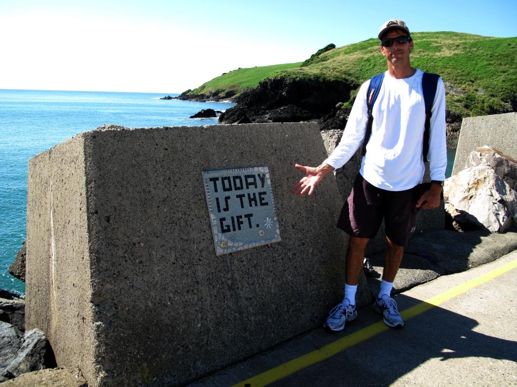 w safe harbors that don’t require crossing a bar. For anyone not familiar with bars (not the drinking kind), these are shallow areas that can form where a river meets the open ocean. Many of these bars are navigable, but only in the right conditions. Typically you need to cross a bar at 1 to 2 hours before high tide and you need the swells to be small. As an added challenge the location and depth of the bars change frequently, so up to date local information is essential. We have had a large easterly swell for the past week, so bar crossings are not in the cards for us right now. So we have been waiting for a weather window to get us all the way to Mooloolaba about 250 miles north. Getting back to Moolo
 olaba means that we will be leaving the Tasman Sea behind and getting back into the Coral Sea and the southeast tradewinds. Tomorrow may be the day…
Monday, April 8, 2013 – America Bay, Cowan Creek, Australia
We left Iron Cove last Thursday and dropped anchor in the beach town of Manly to clean the bottom of Hokule’a and to say goodbye to our friends Aaron and Dene. We met Aaron on his boat Inca in Bora Bora in 2011 and have kept in touch ever since. They live in Manly and were amazing hosts during our stay in Sydney, having us over for dinners, offering us a car, providing us with a wealth of local knowledge on everything from where to anchor, good restaurants, what sites to see, how to find boat parts, and even where to surf. That’s one of the hard parts about cruising, meeting and getting to know really great people and then sailing off not knowing when or if you will ever cross paths again. We have met so many wonderful people in Sydney and it made leaving the city that much harder. On Saturday as we sailed past Sydney Heads and out of Sydney Harbour, we just kept thinking about how happy we were that we had made the effort to get down here. Hopefully the weather will be kind to us on the way back up and won’t give us any reason to second guess our decisionJ .
After passing Sydney Heads we sailed (actually motored) about 30 miles up to Broken Bay, down Cowan Creek to one of the calmest and most protected anchorages that I have ever been in. It’s called America Bay and it’s located in the Ku-ring-gia National Park. The bay is surrounded by densely forested hills and there is an amazing waterfall at the head of the bay. On Sunday we jumped in the dingy and headed to a small town called Patonga about 30 minutes away to meet up with our friends Mike and Liz on the boat Aurora B and Geoff and Judy on Kamate. Aurora B, Kamate and Hokule’a made the trip down the coast together from Moreton Bay to Pittwater back in November of last year. We had a great afternoon together, but once again we were saying good bye to friends with no idea when we would see them again.
Looks like we have a decent weather window to get a little further north, so we are heading over to Pittwater for the night and heading north first thing in the morning.
~~~~~  ~~~~~
~~~~~  ~~~~~
~~~~~  ~~~~~
~~~~~  ~~~~~
~~~~~
Tuesday, April 2, 2013 – Iron Cove, Sydney, Australia
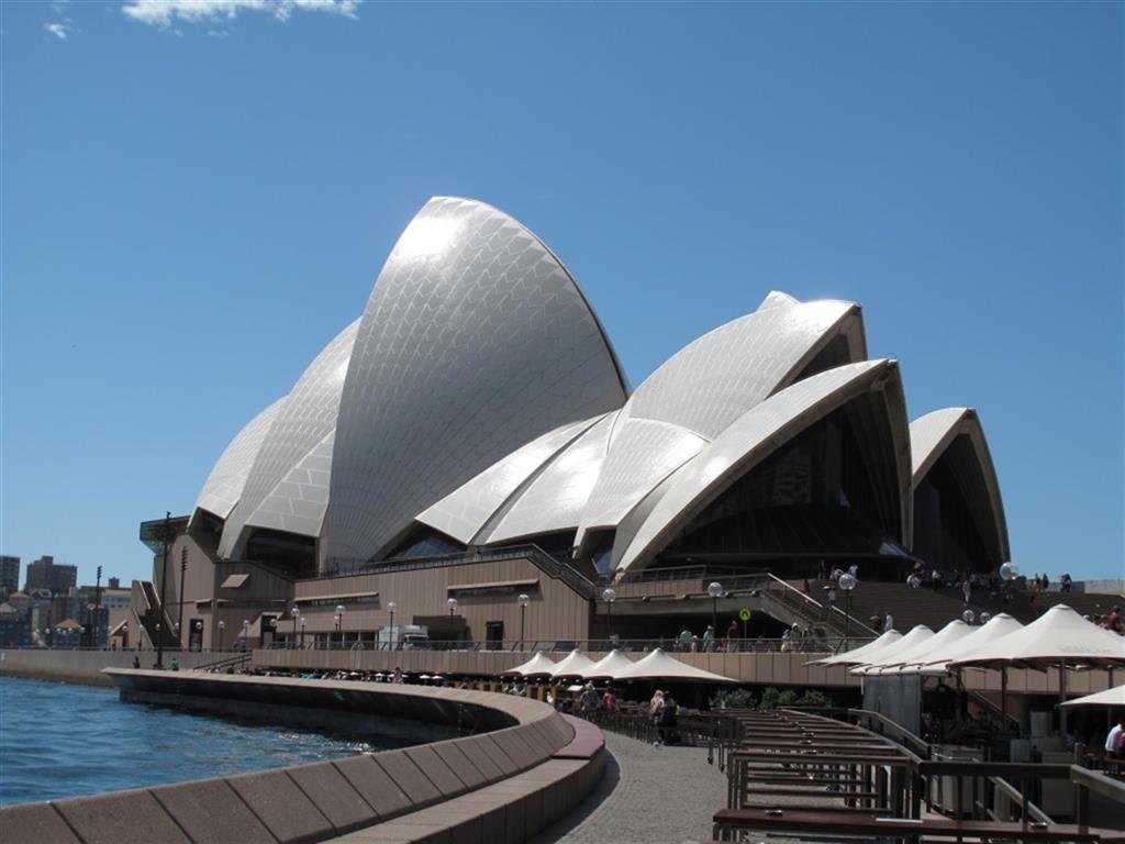
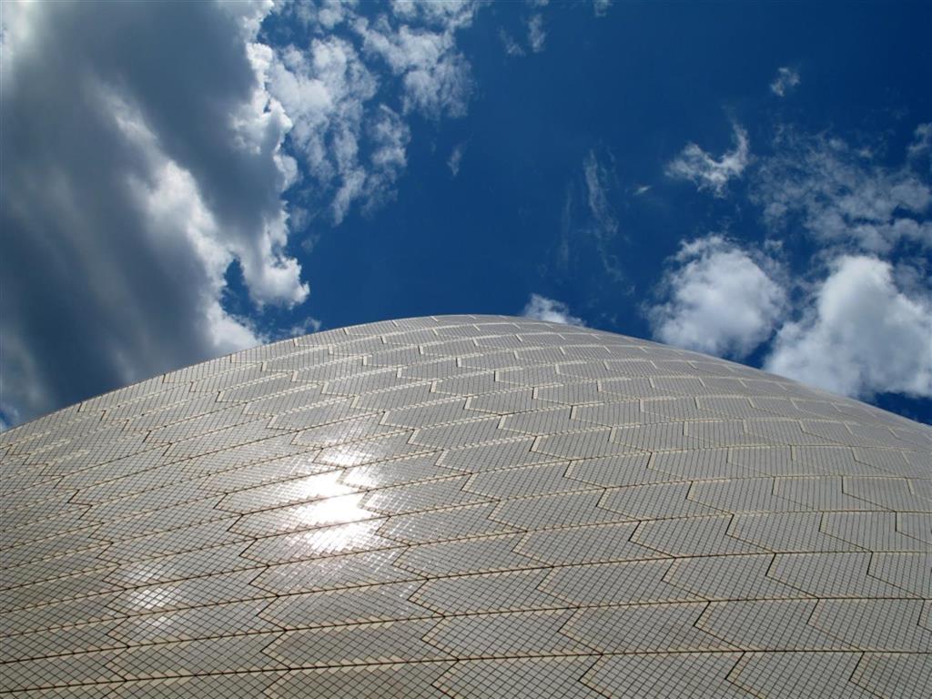
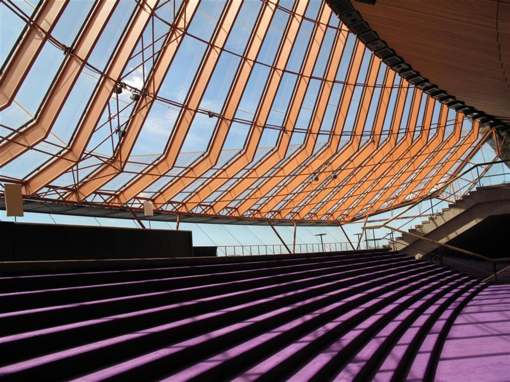
This past week we finished up some boat projects, completed our provisioning, said goodbye to friends, and did a few last minute touristy things including a tour of the Sydney Opera House.
The worst boat project was having to get in the water to clean the prop. Birkenhead Marina is located near the mouth of the Parramatta river in the back of Sydney Harbour. Things grow really fast underwater in rivers because of all the nutrients in the water and since Hokule’a had been sitting still in Birkenhead marina for over 2 months, we knew that the prop was probably covered with barnacles. The problem was we couldn’t see it because the water was that typical muddy brown river water. We talked about waiting to clean it until we moved Hokule’a out to the clear waters of Manly (where we planned to clean the entire bottom of the boat) but we were in a really tricky berth and needed a clean prop to be able to maneuver the boat safely out of the marina. Apprehensively, I put on my scuba gear, grabbed a scraper, and lowered myself into the water. I couldn’t see my hand in front of my face, so I felt my way down the rudder and over to the prop. I could feel that the prop was completely encapsulated with barnacles, coral worms, sea grass, small oysters, and who knows what else. Needless to say, it was an interesting experience trying to clean the prop basically with my eyes closed and wondering if any second now a bull shark was going to have me for lunch.
~~~~~~~~~~  ~~~~~~~~~~
  ~~~~~~~~~~
  ~~~~~~~~~~
Thursday, March 21, 2013 – Birkenhead Point, Sydney, Australia
We got back to Sydney yesterday after a wonderful 6 week visit back to the States. Three weeks on the east coast and three weeks on the west coast. When we were planning the trip we thought 6 weeks was going to be a really long time, but as it turned out the time just flew by and, unfortunately, we did not get to see half the people that we wanted to. One of the highlights for me was going to my niece and nephew’s elementary school (which is the same elementary school that I went to) to do a show and tell about our sailing trip. It was a lot of fun and thanks again to Ms. Tulli for arranging it and thanks to all the students for your wonderful letters. I think the highlight for Jackie was hangin g out the house with her mom and sister doing what looked to me like absolutely nothing, but Jackie calls it relaxing. The visit just further reminded us how fortunate we are to have such great friends and family. Thank you to everyone for your kindness with dinners, places to stay and vehicles, but most of all for taking time out of your busy lives to spend some of it with us. Unfortunately, my camera was broken for most of the trip but there are a few photos (thanks to everyone who emailed them to us) in the photo gallery under “US visit 2013”.
So now it’s back to reality and time to get the boat (and ourselves) ready to start heading north for the winter. Over the next 4 months we will be working our way up the east coast and over the top of Australia to Darwin nearly 3000 miles away. But today, I think we will take a page out of Jackie’s playbook and try to relax. We will see how long that lasts for me…..
We left the marina yesterday and dropped anchor in Iron Cove. Solstice was there to greet us and we are excited to be heading north with Bill. It is always a really good feeling to be back at anchor after being stuck in a marina for a while. But that good feeling is mixed with a bit of sadness because it means that we will be leaving Sydney very soon...
Wednesday, February 27, 2013 – California, USA
We are currently back in the States for a quick visit and will update everyone upon our return. In the meantime, here is a newspaper article about a couple people you might recognize.
Beach Valentines: Love Around the World
Monday, January 28, 2013 – Birkenhead Point, Sydney, Australia
It’s raining cats and dogs here today as the remnants of Tropical Cyclone Oswald pass over Sydney. So since I am stuck inside the boat and most of our inside projects are done, I decided that I would start working on the paperwork for renewal of my Captains license which expires in a few months. One of the requirements for renewal is to document my sea time, so I pulled out our logbook and started flipping through the pages. I got a little sidetracked looking at all of the places that we have been and I noticed a few interesting tidbits from the logbook. Well at least I thought they were interesting, Jackie not so much. But here goes anyway….
- We just broke the 12,000nm(nautical mile) mark having travelled 12,006nm since leaving Redondo almost 2 years ago.
- Our first year we travelled almost twice as far as we did our second year (7,821nm vs. 4,185nm)
- We spent 63 days at sea our first year versus 36 days at sea our second.
- Based on engine hours, we motored nearly 20% of the time our first year and nearly 30% of the time our second year. These percentages seemed really high to me until I added up how many gallons of diesel we have bought in the last 2 years…. almost 800 gallons! Granted some of which was used for battery charging.
- Our slowest sailing day was 85nm in 24 hours which was on our trip from Tonga to New Zealand.
- Our fastest sailing day was 200nm in 24 hours which was on our trip down the east coast of Australia.
- The deepest spot we have anchored in was 86’ deep off of Tapuamu on Tahaa.
- The shallowest spot we have anchored in was 12’ of water in the Bay of Islands at Vanuabalavu.
- Only 5 times have we experienced sustained winds (not a squall or gusts) of 30 knots or more while underway and only 3 of those times did the wind reach gale force (34 knots or higher). The highest sustained wind that we have experienced was actually at anchor in Musket Cove, Fiji at 43 knots.
Sunday, January 20, 2013 – Birkenhead Point, Sydney, Australi a
a
Today was the hottest day on record in Sydney. It was 115 degrees outside of the boat and 100 degrees inside the boat. So much for getting anything done today…
Thursday, January 10, 2013 – Birkenhead Point, Sydney, Australia
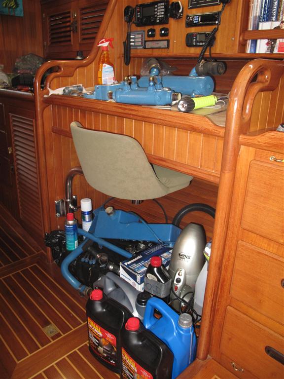
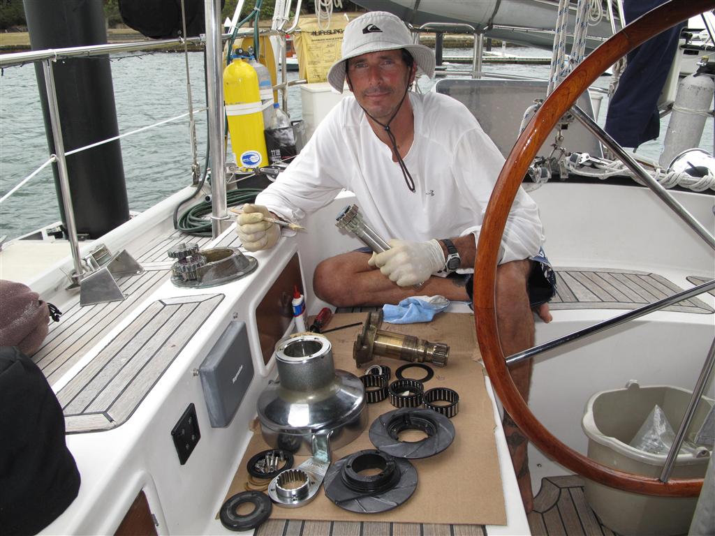
Earlier this week we moved Hokule’a across the harbor to Birkenhead Point. It’s only ¾ of a mile from Woolwich, but it’s a world of difference because there are no ferry wakes. Our new found calmness has allowed me to dive head first into a bunch of engine maintenance projects while Jackie is working on the exterior varnish. Besides the routine filter and fluid changes, I disassembled and cleaned the entire cooling system including the heat exchanger and tranny/oil cooler, rebuilt the raw water pump, replaced engine hoses, and replaced the alternator and voltage regulator. Jackie swears that at one point during this work there were more parts of the engine on the workbench and chart table than there were left in the engine room. Replacing the alternator became a major ordeal because I had to rewire the entire engine wire harness. In between expletives, I tried to be thankful that I discovered this issue in a nice calm marina instead of at sea where you normally find out about these things.
We are trying to get an impossible list of boat items completed before we fly back to the States at the end of the month while at the same time trying to experience more of Sydney. January is a great time to be here because Sydney hosts a month long arts festival with hundreds of events including theatre, dance, music, visual arts, and film. The festival ends on January 26th with a holiday known as Australia Day (Australia’s version of our 4th of July) where there are ferry races, boat parades, tall ship races, air shows, concerts and of course fireworks. Gotta get back to work so that we can go play.
~~~~~~~~~~  ~~~~~~~~~~
  ~~~~~~~~~~
  ~~~~~~~~~~
Sunday, January 6, 2013 – Woolwich Marina, Sydney, Australia
Today is the worst day of the year for Jackie because it’s time to take down the Christmas decorations. 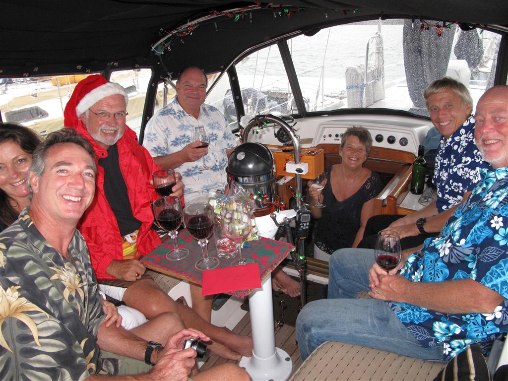 Seems like just yesterday she was running around like a Tasmanian devil putting them all up. We had a great Christmas with 9 of our cruising friends joining us onboard Hokule’a for a huge Christmas dinner. Gary and Jackie from Inspiration Lady and Kennedy (aka Santa) from Far Star drove down from Brisbane, Tiara flew in from New Caledonia, while Mike and Liz from Aurora B and Bill and Sue from Camomile brought the boats down from Pittwater. Bill from Solstice has the shortest trip as he is right beside us here in the marina. It has been really fun to have a bunch of people in town and to explore a bit of Syd
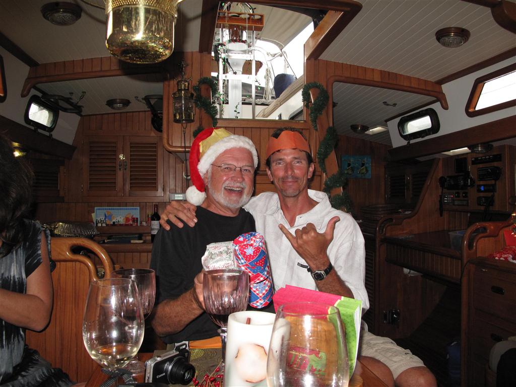 ney together.
Sydney is an amazing city that to me is sort of a mix between New York and San Francisco but with some really beautiful beaches thrown in. Great parks, museums, architecture, restaurants, shopping and entertainment, all centered around the harbor. The harbor is certainly the heart of the city. Sydney has everything that you would typically expect for a large metropolitan city and surprisingly it has a public transportation system that really works. With a combination of buses, ferries and trains, you ca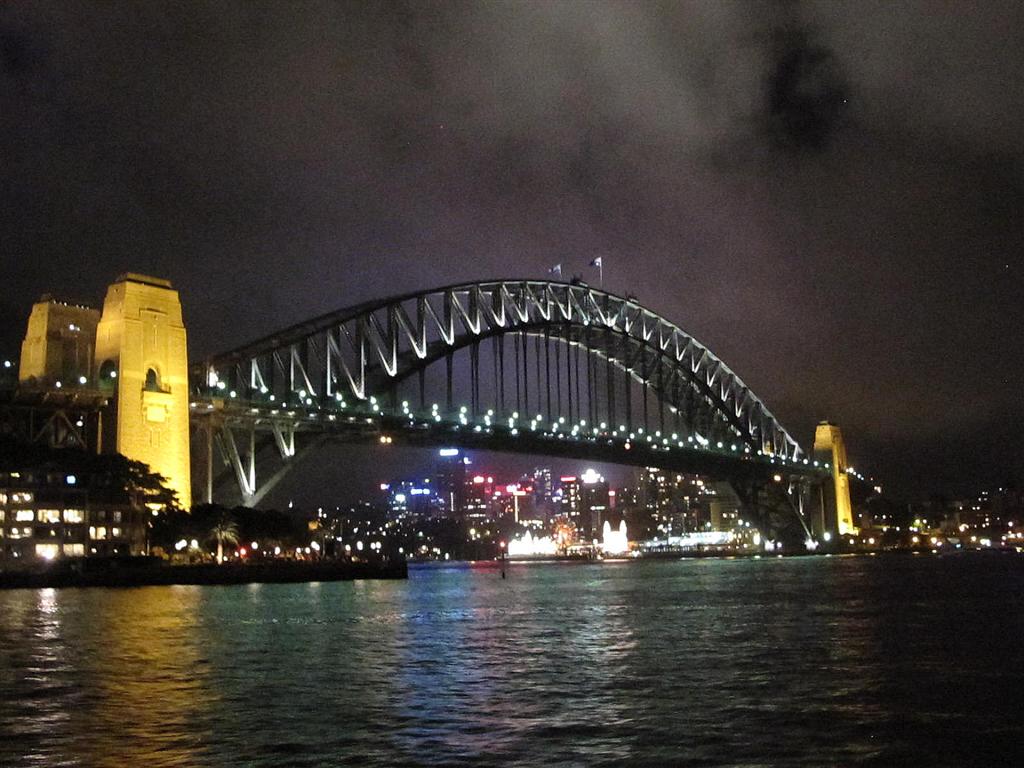 n get anywhere you want to go quickly and relatively cheaply. Ferries have become my favorite mode of public transportation, but there is a downside in that these same ferries create wakes that make the marina here really uncomfortable at times. We even had to build a special brace and use bungy cords to keep the Christmas tree from falling over.
The day after Christmas is called Boxing Day here and it is also the start of the famous Sydneyto Hobart yacht race. The 630 nautical mile race has been held for the past 67 years and is considered o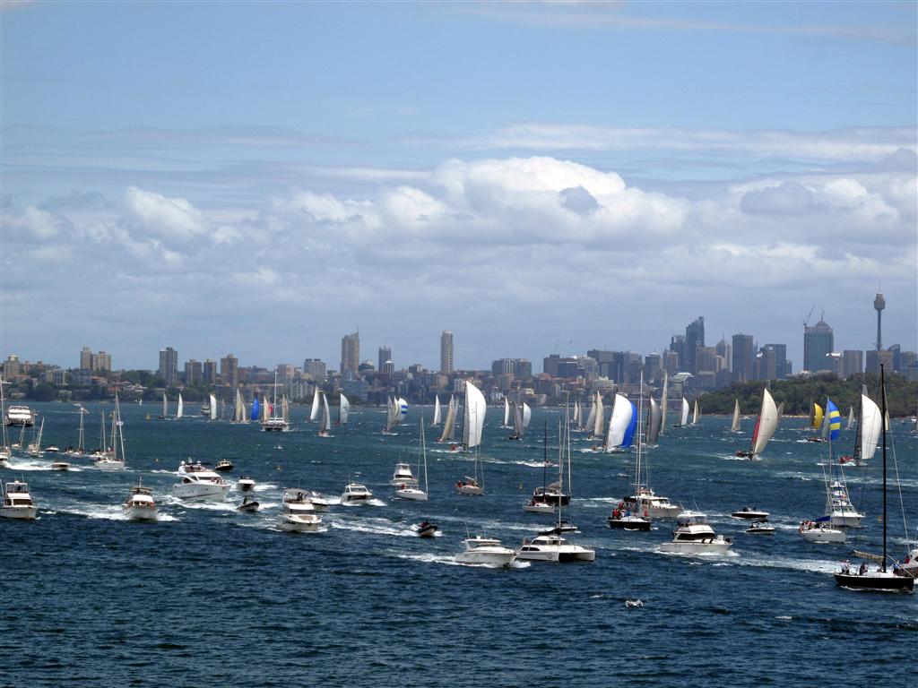 ne of the most difficult races in the world due to the typically strong winds, big seas, and currents. Unfortunately it is probably best known because of the 1998 race where 5 boats sank and 6 people lost their lives. Watching the start of the race is apparently a summertime tradition for most Aussies and there were thousands of people lining the shores of Sydney harbor to watch. In addition to the roughly 80 race boats, hundreds of Aussies joined them on the water in everything from kayaks to mega yachts. It was a complete zoo. Bill had offered for all of us to go out on Solstice to watch the race from the water, but after seeing all of the craziness on the water we were all very happy tobe watching from a beautiful bl
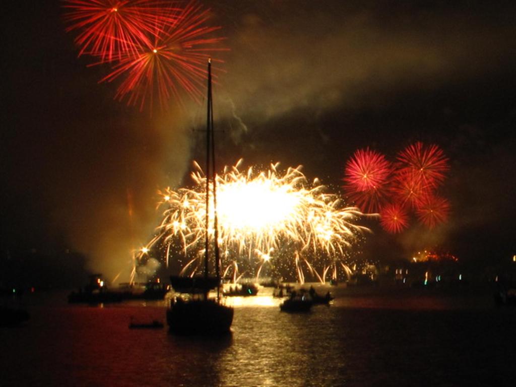 uff overlooking Sydney Harbour.
New Year’s Eve is another Sydney tradition and once again Aussie’s lined the shores and took to the water to watch the festivities which included several fireworks shows, a boat parade, a mini air show, and a traditional aboriginal smoke ceremony. With a great view of the bridge and the city from our marina, we had a small dock party and watched the festivities from the comforts of home. The firewor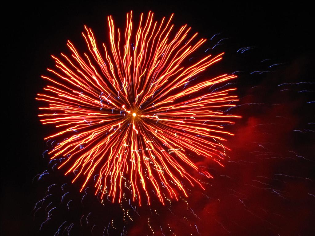 ks were awesome.
But today the party is over and the next several weeks will be mostly about working on the boat with a little bit of Sydney exploration mixed in.
Happy New Year!!!!
Monday, December 17, 2012 – Woolwich Marina, Sydney, Australia
Well we are back in Sydney after a wonderful, but very quick, week in Tasmania. As it seems with mo st places our visit there just wasn’t enough time and we could have easily spent a month or more there. For anyone that doesn’t know, Tasmania is an island that is located about 150 miles south of the Australian continent. From Sydney it’s a 2 hour plane ride or it’s a 5 day sail if you get lucky with the weather. On the map Tasmania looks tiny compared to Australia, but it is actually pretty big at roughly 24,000 square miles. One of the best things about Tassie (the Australian nickname for Tasmania) is that nearly 40% of the island is national park.
We flew in to the capital city of Hobart (probably best known as the finish line for the famous Sydney to Hobart yacht race) to pick up a campervan. I had hoped to be able to talk Jackie into getting a small car and sleeping in our tent, but she wasn’t exactly thrilled with that idea mostly because it snowed last week in several of the places we planned to camp. Tasmania is definitely a place where you can get all 4 seasons in a day and sometimes in an hour. The other reason she wasn’t thrilled was because of the abundance of wildlife which included kangaroos, wallabies, echidnas, wombats, Tasmanian devils, and some of the strangest birds that I have ever seen. Not to mention that 7 of the 10 most venomous snakes in the world live in Australia. There is so much wildlife in Tassie that the rental car companies strongly discourage people from driving at night and with the amount of “road kill” we saw on the pavement every day I was surprised that there was any wildlife left. Admittedly, the campervan ended up being pretty convenient and we probably got to see more because we didn’t have to “break” camp every time we went s
![]() omewhere new. I also got to sleep through the night without being woken up and asked “what’s that noise?”. Click on the tab to the right called “Tasmania at Night” to hear what our campsite sounded like our first night out of Hobart.
omewhere new. I also got to sleep through the night without being woken up and asked “what’s that noise?”. Click on the tab to the right called “Tasmania at Night” to hear what our campsite sounded like our first night out of Hobart.
During our week in Tasmania we drove about 600 miles in total, travelling up the east coast, across the island and over the mountains to the west coast, then inland back to Hobart. Tasmania is a wild, beautiful and visually diverse island that deserves so much more than a week of our time.
Below is the “cliff notes” version of our week for those of you who might be considering a trip to Tassie.
- Sunday – Arrival in Tassie. Spent the night at 7 mile beach near Hobart.
- Monday – Up early for a beautiful drive up the east coast and out to Freycinet National Park. Did
 a half-day bushwalk out to Wine Glass bay and back. Absolutely gorgeous and lots of wildlife. Dozens of great hikes here. Spent the night at Freycinet National Park.
 - Tuesday – Continued up the east coast to St. Helens and then headed inland to the Tamar Valley wine region. Visited a few of the wineries and spent the night near Launceston.
- Wednesday – Up early for a beautiful forested and mountainous drive to Cradle MountainNational Park. Did a half-day bushwalk around Dove Lake at the base of Cradle Mountain. Again dozens of amazing hikes here including the famous 6 day Overland Trek. Spent the night at Cradle Mountain National Park.
- Thursday – Up early for a half-day hike up to Marion’s Lookout on Cradle Mountain. Then dr
 ove west out to the coast near Strahan so I could get my feet wet for the first time in the Southern Ocean (way too cold for a swim). Spent the night in Strahan.
 - Friday – Up early for the drive back to Hobart through stunning rainforests and alpine country sides. Spent the afternoon at MONA (Museum of Old and New Art). Spent the night at Cameron Bay (next to MONA).
- Saturday – Lazy morning. Then headed into downtown Hobart for the Salamanca Place market and a stroll around the harbor. Spent the night in Barilla near the airport.
- Sunday – Mid-day flight back to Sydney.
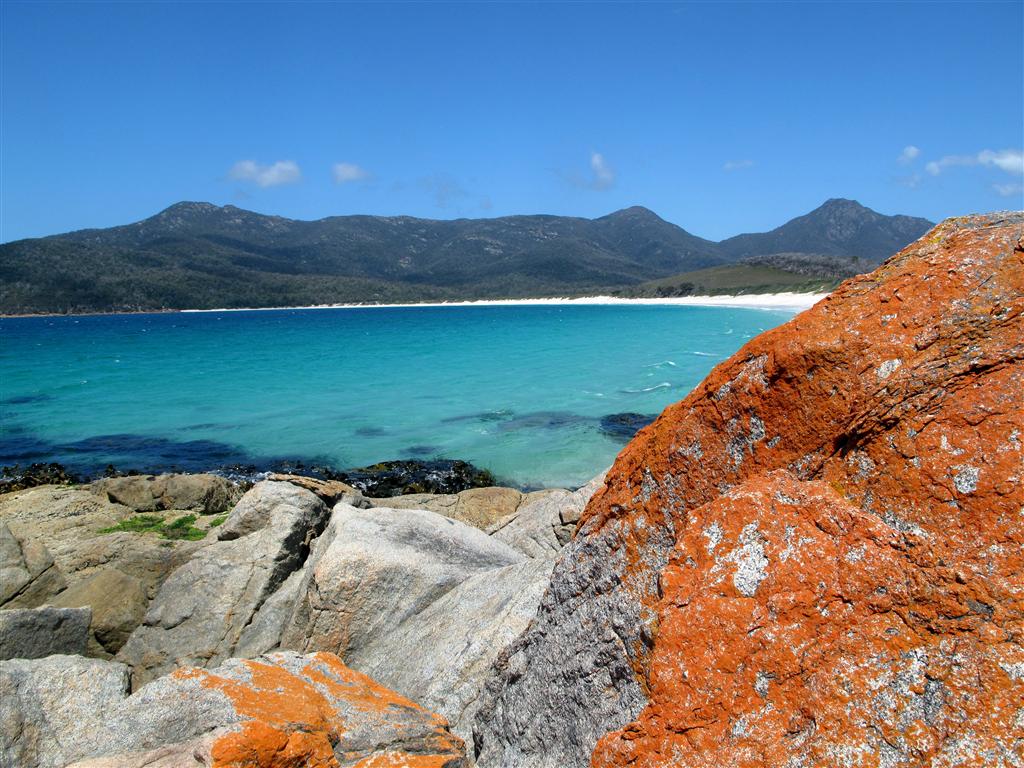
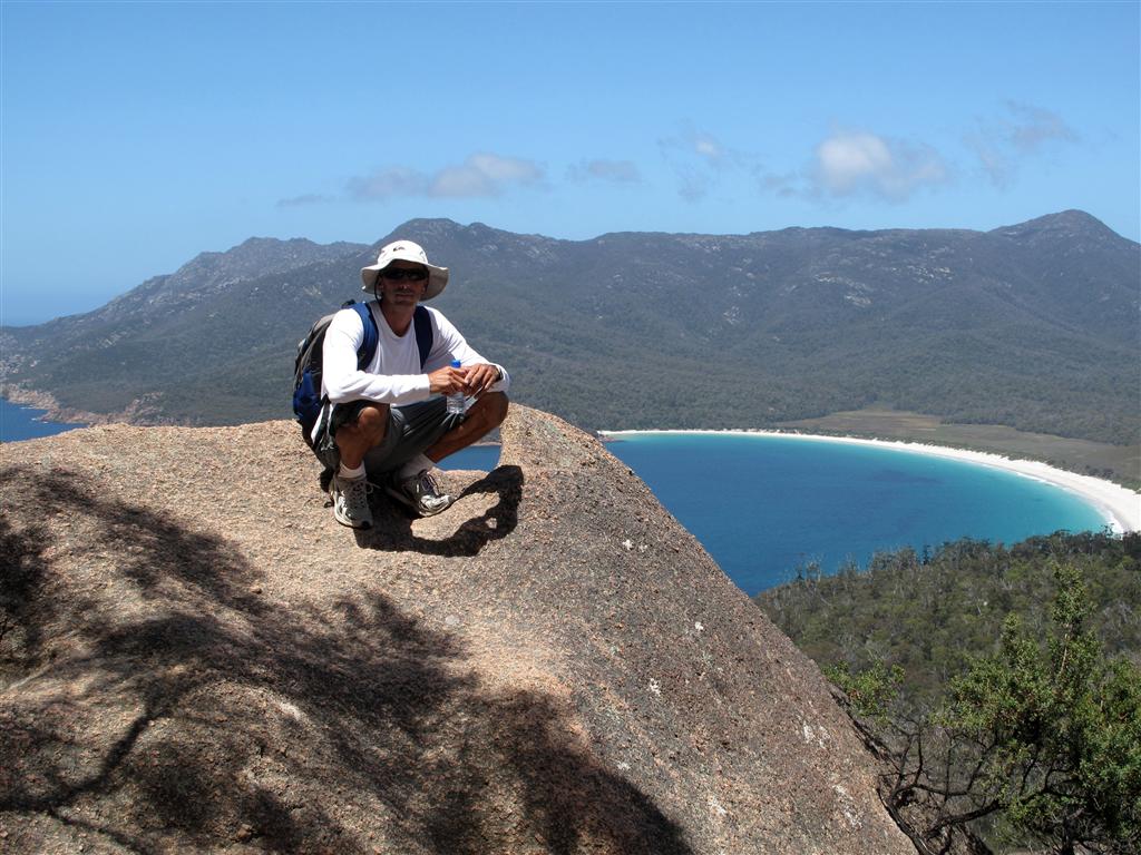
~~~~~~~~~~ 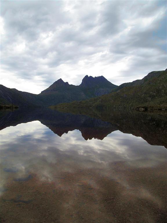 ~~~~~~~~~~
 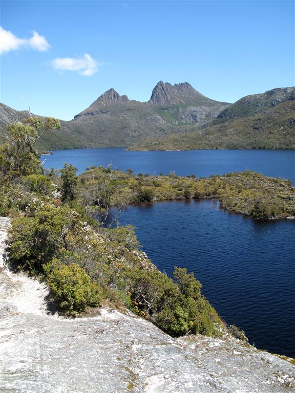 ~~~~~~~~~~
 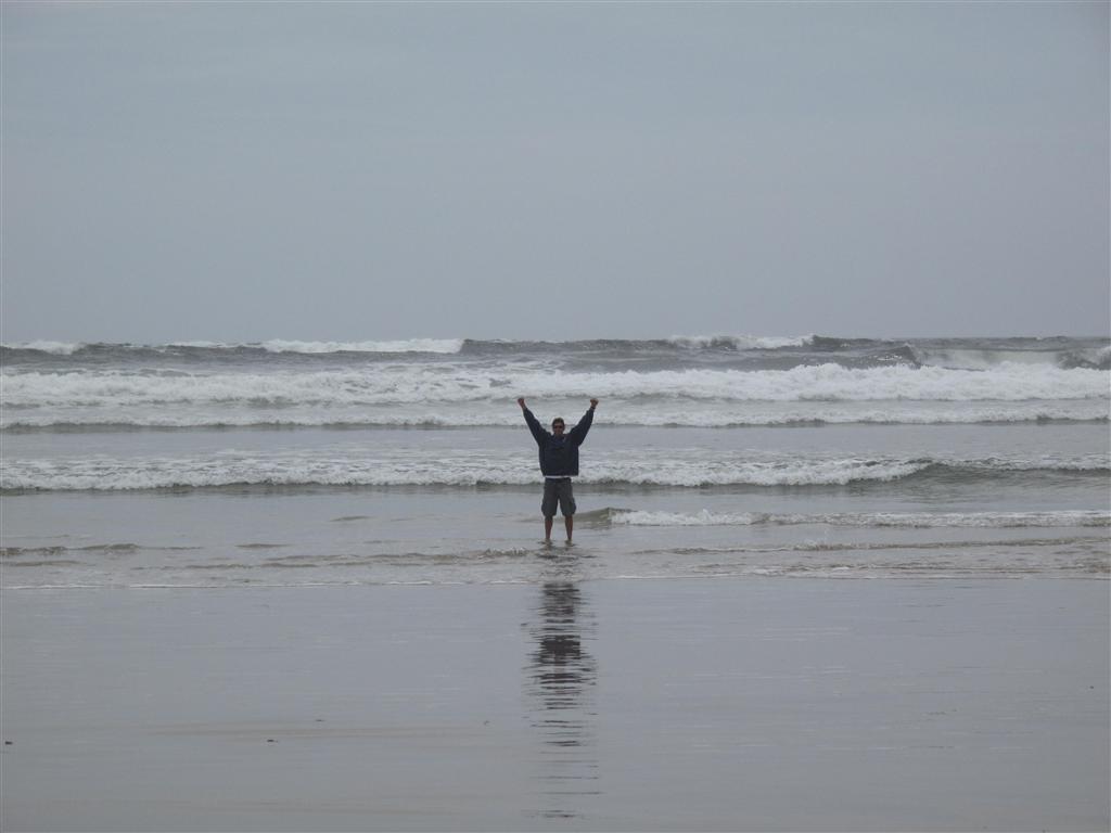 ~~~~~~~~~~
Sunday, December 9, 2012 – Hobart, Tasmania, Austr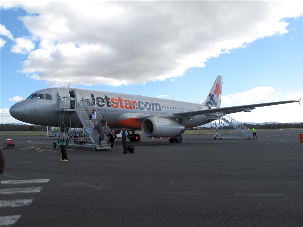 alia
alia
Well so much for staying in one place for very long. After being in Sydney less than a week, we decided that we should take a trip to Tasmania. Its somewhere that we had always wanted to go, but knew that we wouldn’t have enough time to sail there. So this morning we headed to the Sydney airport and as they say, nothing travels through the Roaring 40’s like an Airbus A320.
Tuesday, December 4, 2012 – Woolwich Marina, Sydney, Australia
After 5 days on the Gold Coast anchored in Bum’s Bay we got a great weather window and made a 400 mile jump from the Gold Coast to Pittwater. On the trip we set a new speed over ground record for Hokule’a at 14.1 knots and a new 24 hour mileage record at 200 miles. Granted we were in the East Australian Current (3-4 knots) and for a while we had sustained winds of 30 knots gusting to 38 knots behind us, but hey a record is a record. Needless to say it was a quick trip. We then spent a week in Pittwater moored off of Scotland Island, before making the final 32 mile jump to Sydney yesterday. Unfortunately it was raining most of the day, but that didn’t diminish the excitement of seeing the Opera House for the first time and then sailing under the Sydney Harbour Bridge. Today the sun is shining and we are tied up in a marina called Woolwich where we have a great view of the bridge and the city. We are really excited to be here and we are looking forward to exploring Sydney. We are also looking forward to being in one place for a little while.
~~~~~ 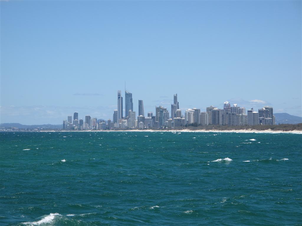 ~~~
~~~ 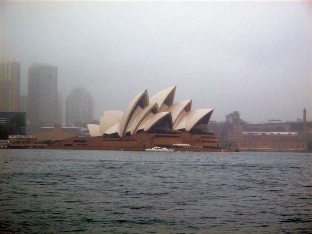 ~~~
~~~ 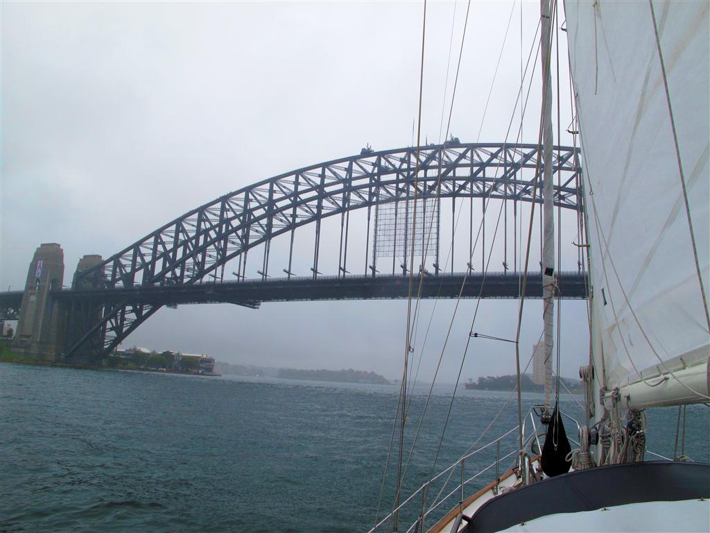 ~~~
~~~ 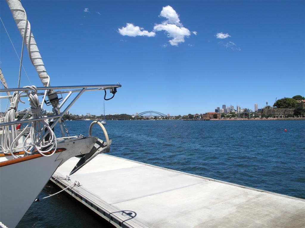 ~~~~~
~~~~~
Tuesday, November 20, 2012 – Bums Bay, Gold Coast, Australia
We set a personal record today with the greatest number of waypoints that we have ever used to make a passage. And what’s really shocking is that it was one of our shorter passages….. 87 waypoints to go a mere 45 miles! As a comparison, we only had 6 waypoints on our entire 800 mile passage from New Caledonia to Australia. For those of you who aren’t that familiar with waypoints, a waypoint (in this case for nautical navigation) is a point on the earth’s surface that has a known latitude and longitude. We pick waypoints off of a chart to help us navigate safely from place to place avoiding reefs, shallows, islands, etc. We then enter the latitude and longitude of each waypoint into our GPS and use the GPS to guide us from waypoint to waypoint. It took me over 2 hours to enter all 87 waypoints into the GPS.
The reason for so many way points is that we were travelling through a series of rivers and estuaries called the Broadwater that lies between Moreton Bay and the Gold Coast. The Broadwater is a challenging place to navigate and can be quite confusing because of the numerous rivers, streams and channels to choose from. (Check out the google earth image below and the white line showing the path we took.) Some of the channels are very narrow, it has constantly shifting sandbars, and above all it is very shallow. So shallow that part of the route we took actually dries out at low tide. Because of this you have to “work the tides” and plan to arrive in the shallow spots at high tide and hangout in the deep spots at low tide.
We had a perfect sunny Australia day to make the trip and even better our friends on the boat Aurora B offered to go first (their keel is 6” deeper than ours :)). Our “working the tides” plan worked out well as we made it through in about 9 hours and we didn’t run aground. Our depth alarm, which is set to go off when the water is 10 feet deep or less, only went off 5 or 6 times and the shallowest water we saw was 8 feet deep (our keel is 6.5 feet deep).
Tonight we are anchored in a great spot called Bum’s Bay, with awesome views of the Gold Coast, and 15 feet of water depth at low tide. It’s nice to be in some deep water for a change…..
~~~~~~~~~~~~~~~~~~~~~~~~~~~~~~ .jpg) ~~~~~~~~~~~~~~~~~~~~~~~~~~~~~~
~~~~~~~~~~~~~~~~~~~~~~~~~~~~~~
Friday, November 16, 2012 – Moreton Bay, Australia
Yesterday, I forgot to mention something that happened on our trip to the Lone Pine Koala Sanctuary. We were watching a mother kangaroo show her “joey” (Aussie word for young kangaroo) which shrubs and grasses to eat, when off in the distance someone started up a very loud weed-eater. The joey hopped straight towards the mother and dove head first into her pouch. For a moment all you could see was its black tail hanging outside of her pouch, until eventually he got turned around and stuck his face out to see what the noise was. Just then the weed-eater started up again and the mom hopped away in to the bush with the joey still in her pouch. Now I knew that kangaroos had pouches to carry around their babies, but I was completely shocked at how large of a “baby” that it could accommodate.
~~~~~~ .jpg) ~~~~~
~~~~~ .jpg) ~~~~~
~~~~~ .jpg) ~~~~~
~~~~~ .jpg) ~~~~~
~~~~~
Thursday, November 15, 2012 – Moreton Bay, Australia
Our next stop on “the road” to Sydney was just a day sail south of Mooloolaba to a place called Manly l.jpg) ocated in Moreton Bay. On the way there we were escorted by dolphins, saw sea turtles and had to avoid a couple of curious humpback whales. Moreton Bay is unbelievably alive especially considering its proximity to a major city, Brisbane. It is home to 6 of the 7 sea turtle species found worldwide, has a very large dugong population, and has the largest resident population of bottlenose dolphins in the world.
ocated in Moreton Bay. On the way there we were escorted by dolphins, saw sea turtles and had to avoid a couple of curious humpback whales. Moreton Bay is unbelievably alive especially considering its proximity to a major city, Brisbane. It is home to 6 of the 7 sea turtle species found worldwide, has a very large dugong population, and has the largest resident population of bottlenose dolphins in the world.
Manley is a cute little bayside village with lots of recreational boating and seems to be a weekend retreat for many who live in Brisbane. On Tuesday we rented a car to go check out the city of Brisbane and on the way stopped at a place called the Lone Pine Koala Sanctuary. This amazing place started back in the 1920’s with 2 rescued koalas and today they have evolved into a living zoo with ka.jpg) ngaroos, birds, reptiles, and over 100 koalas. We could have stayed there all day just to watch the koalas.
ngaroos, birds, reptiles, and over 100 koalas. We could have stayed there all day just to watch the koalas.
We found Brisbane to be a beautiful city that has a really good vibe. Built along the banks of the Brisbane river, its modern, cosmopolitan, and has lots of museums, parks and open space. The thing that struck us most about it was how alive the city felt. Restaurants were crowded with people enjoying lunch away from the office while others were spending their lunch breaks running, cycling, or kayaking along the river. They even have built a section of beach along the river with complete with palm trees, swimming areas and lifeguards. There are also boat moorings just off of the botanical gardens and we are hoping that we will be able to spend some more time here on Hokule’a on our way back up from Sydney.
~~~~~~~~~~ .jpg) ~~~~~~~~~
~~~~~~~~~ .jpg) ~~~~~~~~~
~~~~~~~~~ .jpg) ~~~~~~~~~~
~~~~~~~~~~
Wednesday, November 7, 2012 – Mooloolaba, Australia
After a great week in Bundaberg we said goodbye to friends and started our journey south towards Sydney. It was an overnight sail to the Sunshine Coast where we stopped in the town of Mooloolaba. Mooloolaba reminds me a lot of Newport Beach, CA with a great harbor, an amazing beach, and an esplanade with shops, bars, and restaurants with unobstructed ocean views. Definitely a touristy spot, but kinda fun after the “rural-ness” of Bundy. It has also been really nice to be able to go running on a coastal trail, then jump in the ocean for a swim or paddle on my surfboard, and then stop at Starbucks on the way back to the boat. Paradise found.
The only thing missing has been surf, as Moolooaba faces northeast and most of the swell here comes from the southeast. So on Tuesday we rented a car and drove up the coast to a famous surfing spot and town called Noosa. Just my luck that it was an unusually small surf day at Noosa, so instead we explored the town and enjoyed all the festivities associated with the Melbourne Cup. The Melbourne Cup is horse race where most Aussies take the day off of work, dress up in 1920’s era clothing, and have huge parties. All of this just to watch a 3 minute horse race.
After some great people watching, we headed back to Mooloolaba via the inland route looking for koalas and enjoying stunning views of the Glasshouse Mountains.
~~~~~ .jpg)
.jpg)
.jpg)
.jpg)
.jpg) ~~~~~
~~~~~
Tuesday, October 23, 2012 – Bundaberg, Australi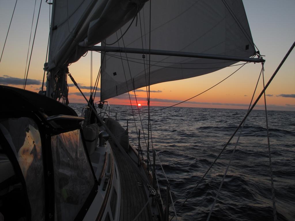 a
a
G’day from the land down under! Our arrival into Australian waters yesterday morning could not have been any better as we had sunny skies, perfect sailing conditions, and several humpback whales splashing their gigantic tales on the water as we sailed by. It was like they were welcoming us to Australia. By sunset we had cleared customs, gotten tucked into the marina in Bundaberg (or Bundy as the locals say), and were celebrating our Australian landfall with a group of friends.
It was a good passage from New Caledonia with mostly light winds and calms seas. Although it was a b it stressful the last few days because we were having to travel as fast as we could in order to get into Bundy before a storm hit. This meant motor- sailing a lot more than we normallyl would have in order to keep the speed up. We were really fortunate in that we got in some 6-8 hours before the storm hit. Several boats behind us were not so fortunate. One boat ended up sinking with the crew being rescued from their life raft, several boats were damaged, and an Aussie Coast Guard helicopter attempted to evacuate a family off of another boat but conditions were too rough to do so. Thankfully everyone is OK.
We sailed to Bundy as part of a rally (basically a bunch of boats sailing to the same place) an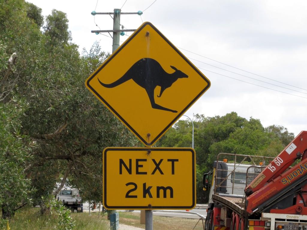 d
d
there are lots of events and activities planned for the coming week. But today we are resting up
from the passage, watching the kangaroos play in the field across from the marina, and simply appreciating that we have made it to Australia.