Around The World On Hokule'a
Bonaire
Monday, November 23, 2015 – Kralendijk, Bonaire
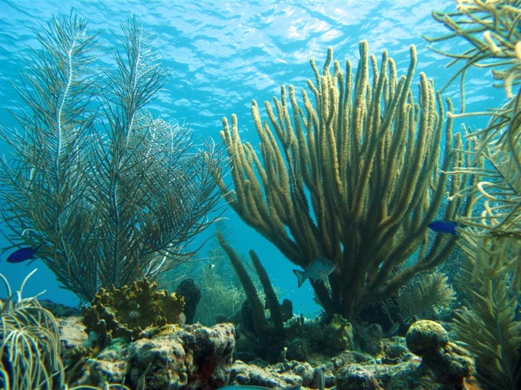
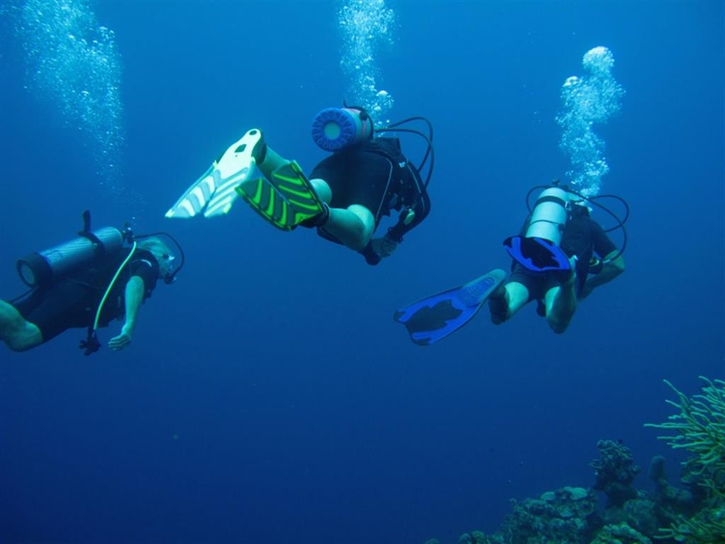
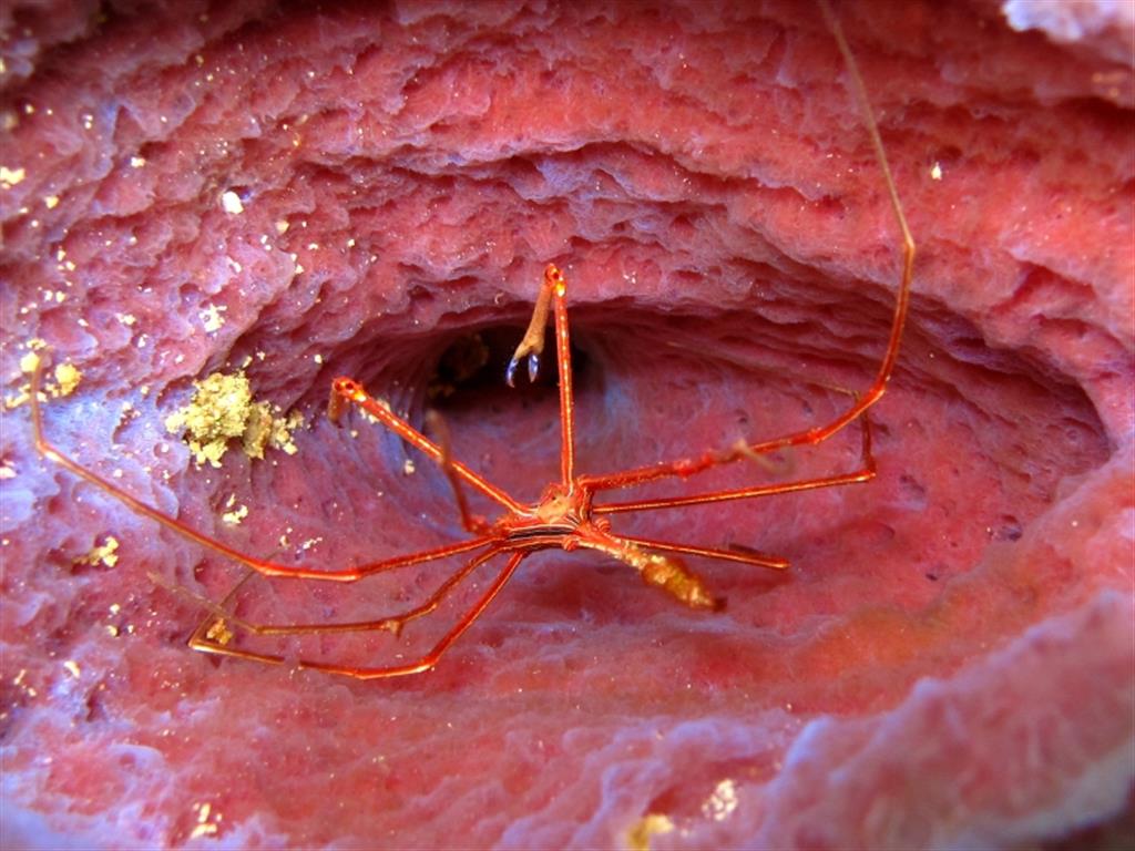
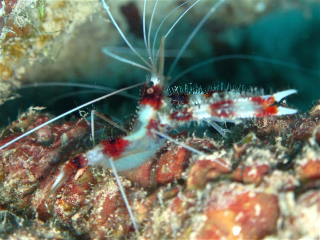
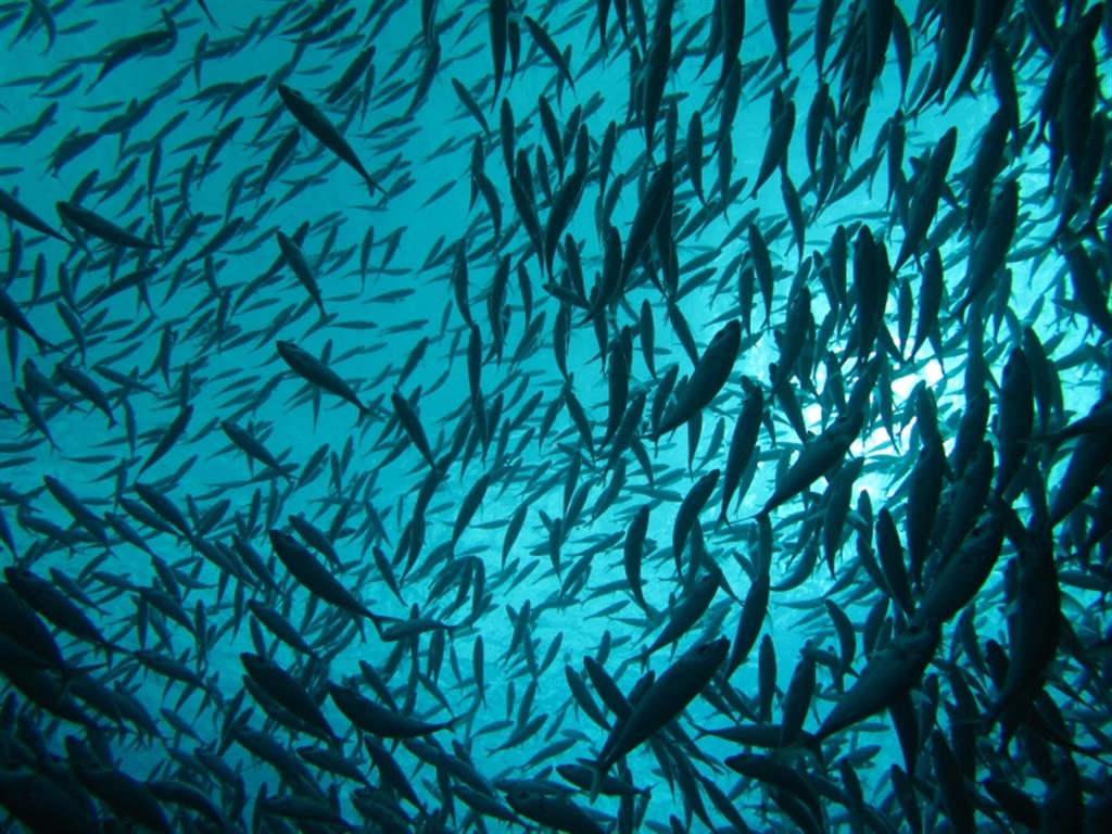
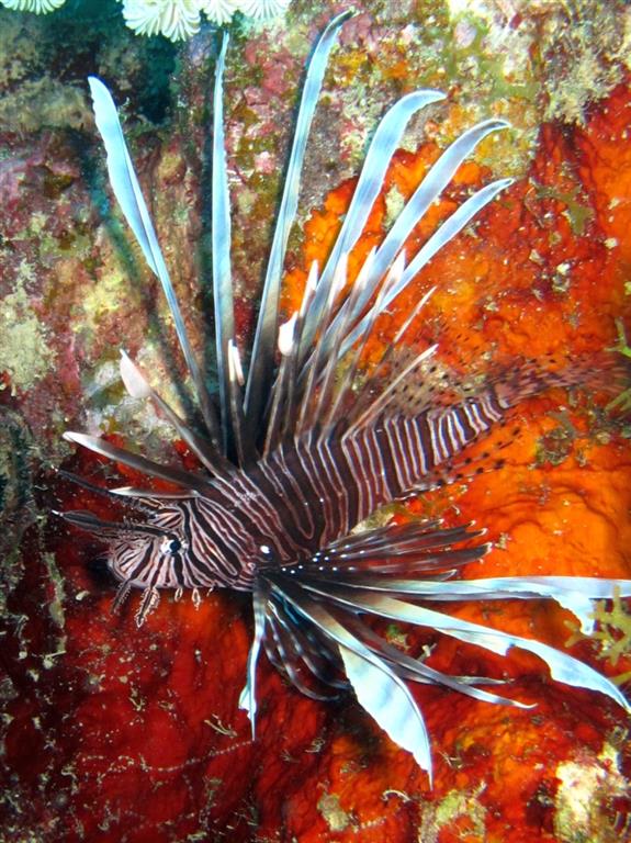
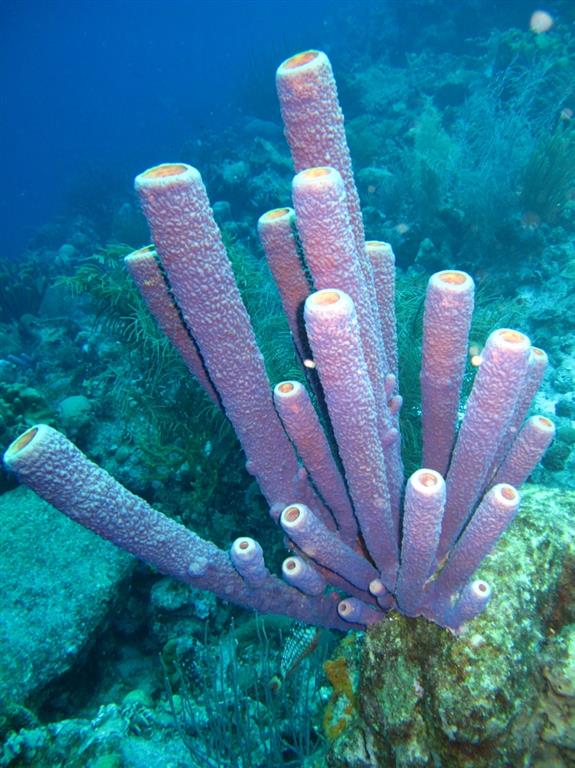
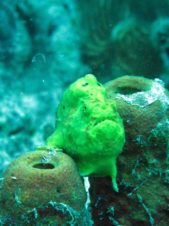
Over the past couple of days I have had the chance to see a bit of Bonaire from underwater with some fellow OCC members, Ken, Judith and Doug. I now understand why the diving here is considered world class because it is truly amazing and it is some of the best diving that I have experienced in all of our travels. Great visibility, nice structure and some very interesting sea creatures. Below are a couple of the million photos that I took and I will let the photos do the talking.
Our next leg to Columbia is very challenging from a weather perspective and we have been keeping a really close eye on the forecasts looking for a window to get there. We are headed to a town called Santa Marta which is on the coast and located at the base of the world’s 5th tallest mountain range called the Sierra Nevada’s. The combination of a semi-permanent low pressure system and the incredibly tall (18,700 feet) mountain range creates consistent gale force and often storm force winds off of this portion of the Columbian coast. Later this week winds in that area are forecast to drop to about 30 knots (today its blowing 50kts with higher gusts) and it looks like that is the best window that we are going to get for a long while. So if the forecast holds we will set sail out of beautiful Bonaire on Wednesday to time our arrival off of Santa Marta on Friday morning. Who would ever think that a forecast of 30 knots would be a good weather window????? I guess we will find out later this week…
Wednesday, November 18, 2015 – Kralendijk, Bonaire
We were a little nervous about the trip from Grenada to Bonaire because the route would take us relatively close to the coast of Venezuela. Unfortunately Venezuela has gotten pretty dangerous for cruising yachts from an armed robbery, kidnapping and piracy perspective and most people recommend staying at about 25 miles offshore of the coast and islands to minimize the risk. So we plotted our course to stay at least that far off and took the additional precaution of turning off the transmit function on our AIS.
On our second day out just before sunset, we noticed a large trawler type boat in the distance that appeared to be heading toward the coast of Venezuela. We tracked it on radar and confirmed that the boat was heading away from us and towards the coast. But just after dark we noticed that the now unlit vessel had changed course and was following us. We watched it on radar for a while hoping that it would turn and go back on its original course, but it didn’t. So we turned off all of our lights and after a few minutes made a 45 degree turn to starboard. We nervously watched the radar and after a few minutes the unlit boat also made a 45 degree turn to starboard and sped up. Crap! Since we had no lights or AIS on, the only way the boat could be tracking us was with radar. Fiberglass boats don’t reflect radar signals very well, so most fiberglass boats have some specially designed radar reflecting device mounted on the mast somewhere so that the boat can be seen on radar. A great idea if you are trying to prevent collisions at sea, but not so good if you are being followed. Fortunately ours is simply hauled up on a flag halyard and can easily be raised or lowered. So after taking our radar reflector down and stowing it below, we made a 90 degree turn to port. We then glued ourselves in front of the radar to see what would happen next. For five minutes or so the boat stayed on course, then it turned to starboard and slowed down, a few minutes later it turned hard to port and sped up again, but finally it did a u-turn and started heading towards the coast of Venezuela. Needless to say we didn’t get much sleep that night.
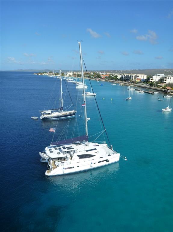
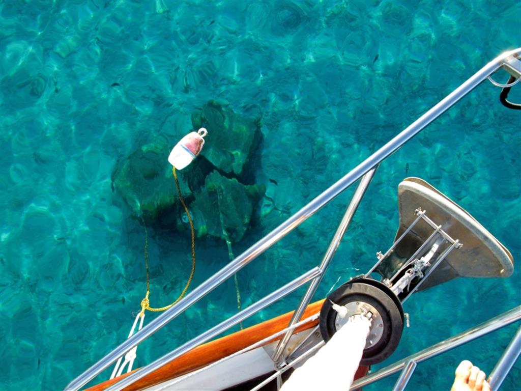
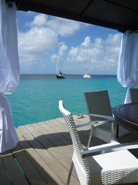
The next day the breeze picked up in the 25 to 30 knot range and we had a sporty sail the rest of the way to Bonaire. The best part was when we got into the lee of the low-lying island, as we still had 30 knots of wind but the seas were flat. We arrived off of the main town of Kralendijk just before sunset and found the last available mooring. Anchoring is strictly prohibited in Bonaire in order to protect the coral reef and they have installed about 40??? moorings for visiting boats to use. The water was so incredibly clear that I could practically inspect our mooring from the foredeck of Hokule’a, but I dove in any way to put on an extra line.
After a great night’s sleep, we were up early to do our international check in and find somewhere for lunch. The dingy dock just happens to be located at a great bar and restaurant called Karel’s Beach Bar that has best ocean view on the island. Bonaire is probably best known as one of the top scuba diving destinations in the world with 87 specific dive sites located within its protected marine park. The majority of the divesites are just a short dingy ride from Hokule’a and I am excited to get in the water. The only problem I have is that Jackie doesn’t scuba dive and we left my dive buddies, Jack and Zdenka, back in Grenada. I actually don’t mind diving by myself, but it sure is a lot more fun when you have others to share the experience with.
Back on the boat that afternoon, we were cleaning up the boat from our passage and we hauled up our Ocean Cruising Club burgee. We joined the OCC a few years back and it is basically a yacht club (without a physical yacht club) that caters to cruisers who are out sailing in the world’s oceans. It has been a great resource for us in just about every part of the world that we have travelled. Well no more than 20 minutes from the time I raised the burgee, a very nice couple in a dingy came up to Hokule’a and introduced themselves. Rob and Rhian were OCC members off of the boat Beyzano and they invited us to an OCC gathering that was taking place at Karel’s Beach Bar that evening. How cool is that? It was a great evening and we met 13 people off of 7 different OCC boats. A few of them were divers so we made plans to go diving later in the week.
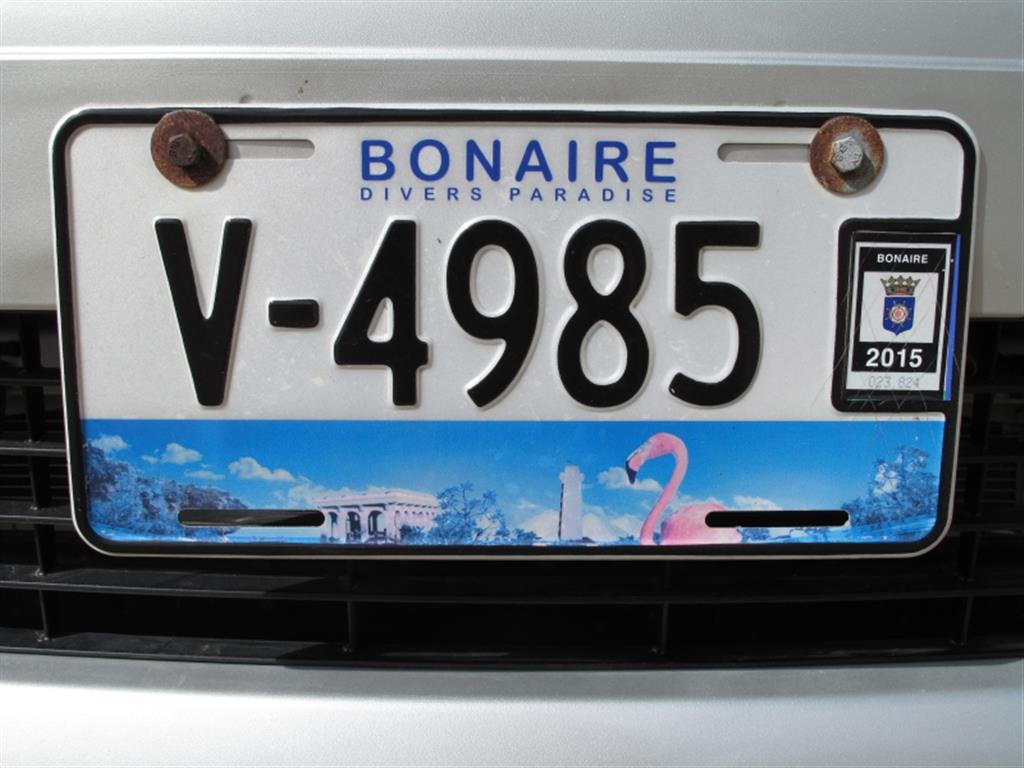
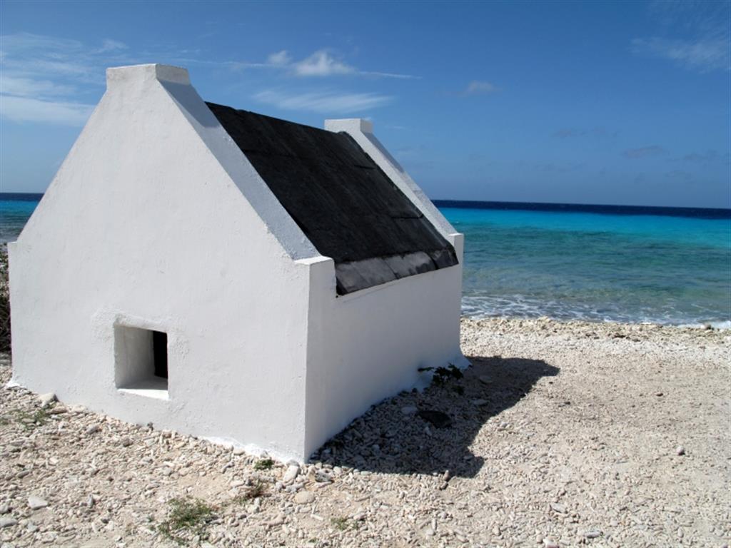
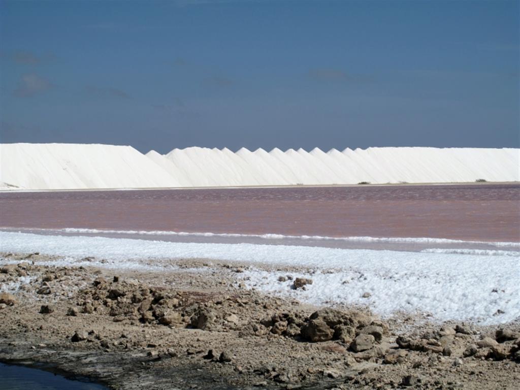
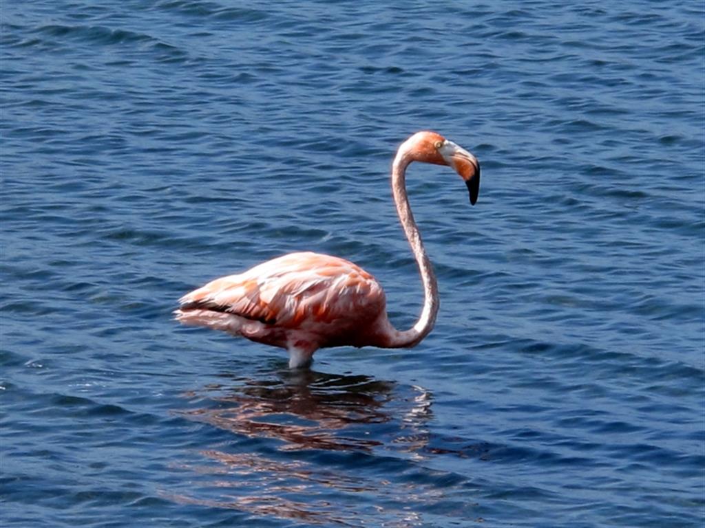
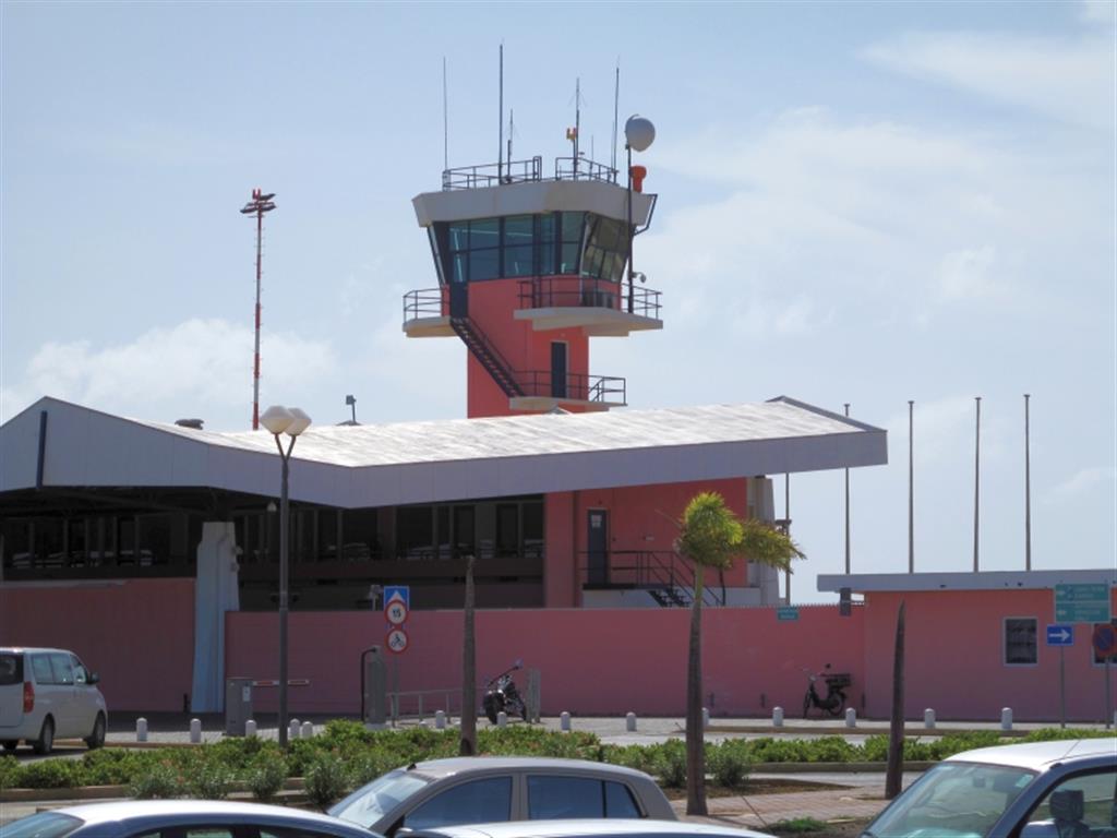
Yesterday, Jackie and I rented a car so that we could drive around the island. It’s a small island, but has lots of diversity. The southern end of the island is low lying and barren with lots of salt pans that have mountains of salt ready to be exported. Years ago, indentured servants were used to work the salt pans and a number of the original “accommodations” for the slaves have been preserved. The west coast is the leeward side of the island and it is very scenic with a rocky coast interspersed with a few white sand beaches. We stopped at one of the beaches to get in the water and snorkel at a spot called “1000 Steps”. The northern end of the island is very hilly and wooded with lots of lakes/estuaries filled with pink flamingos. Apparently the pink flamingo is their national bird and they even painted their airport “pink flamingo” pink. Of course we had to go visit the airport….