Around The World On Hokule'a
Vanuatu
Tuesday, September 18, 2012 – Port Vila, Vanuatu
We arrived back in Port Vila on Sunday afternoon and heard from some fellow cruisers that there was a potential weather window to leave for New Caledonia the next morning (Monday). So immediately I started studying all of the weather models while Jackie organized a provisioning list. I didn’t like what I saw for a Monday departure as conditions would be pretty rough for most of the trip. Tuesday looked a little better for a departure but had the risk of headwinds as we approached New Caledonia. After a brief discussion with Bill, Solstice and Hokule’a decided that we would just wait for the next window which typically occurred about every 7-10 days.
This morning however the forecast improved slightly and it appears that we should be able to get in to New Caledonia before the headwinds fill in. So we are rushing off to provision and clear out of the country. Hope to be underway to New Caledonia early this afternoon….
Saturday, September 15, 2012– Havanna Harbor, Efate, Vanuatu
One of the most frustrating things about cruising is realizing and accepting that you can’t go everywhere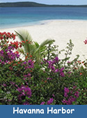 that you want to go. Most of the time it is because of unfavorable weather, sometimes it’s because you are trying to keep to a schedule, sometimes it’s due to poor planning because of a lack of information about the place you want to go, and quite frankly often it is because we are having too much fun where we are at the time. And every now and then you completely lose sight of the fact that you are in a really beautiful and amazing place because you are so focused on the disappointment associated with the place that you didn’t get to go. The past few days have been one of those times for me.
One of the things that I really wanted to do on this trip was to go to Santo in northern Vanuatu to dive on the vast amount of WWII wreckage including the USS Coolidge and Million Dollar Point. Not to mention, the opportunity to hang out at Oyster Island and Champagne Beach. Santo is roughly 150 miles northwest of Efate and while it would be a relatively easy 24 hour sail to get there, it would be a very challenging trip against the trade winds to get back to Efate for our departure to New Caledonia. And by challenging I mean that it could take us several weeks to a month of waiting for weather windows and island hopping to get back to Efate. This basically meant that by going t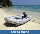 o Santo we would very likely not have enough time to go to New Caledonia because we need to be in Australia by early November to avoid cyclone season. So earlier this week, we made the decision that we would not be going any further north than Efate which meant missing out on Santo.
Needless to say, I have been extremely bummed out the past few days (or pouting as Jackie calls it) and have been thinking about all the other places that we had wanted to go but were not able to for whatever reason. Places like Ua Poo in the Marquesas, Suwarro in the Cooks, Huahine in French Polynesia, and the Haapi group in Tonga. These thoughts just made me grumpier.
Then Jackie (after reminding me of all the amazing places that we did get to go) told me to go out on d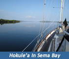 eck and take a look around. Here we were in gorgeous Havanna Harbor about 20 miles north of Port Vila where the entire US naval fleet was based during WWII. Specifically, we are in a cove called Sema Bay which is by far the calmest and prettiest anchorage that we have been to in Vanuatu. A short dingy ride away is the gorgeous Lelepa Island where we had a beautiful snorkel this morning and this afternoon an incredibly kind Vanuatuan gentleman paddled out in his dugout canoe and gave us fresh tomatoes and cucumbers because he saw our American flag. I guess life isn’t so bad after all.
Tomorrow we head back to Port Vila and will start looking for a weather window to head to New Caledonia.
Sunday, September 9, 2012– Port Vila, Efate, Vanuatu
Well we ended up beating the worst of the weather in, but still had to contend with some rain and lightning. F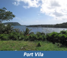 ortunately most of the lightning was on Jackie’s watch while I stayed in my bunk down below with the covers over my head. I really don’t like lightning. However, Jackie got the last laugh in the morning because it was pouring rain as we entered Port Vila harbor and I was confined to the bow reef spotting and searching for a place to moor the boat. Meanwhile, she was warm and dry in the cockpit.
Port Vila is the capitol of Vanuatu and surprisingly it is a very developed city with resorts, restaurants, shops and grocery stores. This was a refreshing change after the remoteness of Tanna and 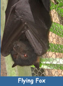 Aneityum and with a great selection of restaurants (plus being completely out of fresh food and vegetables) we ended up eating out our first several nights in port. One night we went to a place thatspecializes in flying fox. Flying foxes are very large bats that can have up to a 5’ wingspan. They are hunted and eaten in most South Pacific nations (in Tonga only the royal family is allowed to hunt and eat them) but this was the first place we had ever seen it served in a restaurant and the first opportunity that we have had to try it. John and I each ordered a flying fox hoping that it would come to the table with its wings and head still attached, but instead it came out looking rather civilized like a small turkey. Unfortunately, it didn’t quite taste like turkey.
Port Vila has a number of shipwrecks around the harbor so Bill, John and I decided to do a dive on 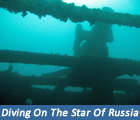 a ship called the Star of Russia. The Star of Russia is a 275’ steel hulled, 3 masted square rigger that was built in 1874 by Harland and Wolfe who, ironically, also built the Titanic. The Star of Russia is also a sister ship to the Star of India which is docked in San Diego as a part of the maritime museum. Unfortunately, the Star of Russia sank during a cyclone that hit Port Vila in 1953. She sank in roughly 100 feet of water and sits upright on the bottom. Her steel hull is still intact, but all of her wooden decking has rotted away which makes it easy to swim around inside of the ship.
Last night Port Vila celebrated “white night” which is a French celebration of the arts. The town was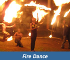 bustling with activities including ceremonial dances, free concerts, art gallery openings showcasing local artists and an amazing fire dancing performance. It was a great way to celebrate John’s last night in town as he flew back to the States this morning. We miss you already Johnboy!
New Vanuatu Photo Album has been added to the Photo Gallery
Saturday, September 1, 2012– Port Resolution, Tanna, Vanuatu
As we were sailing into Port Resolution (on the island of Tanna about 50 miles northwest of Aneityum) I tr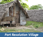 ied to imagine what was going through Captain Cook’s mind as he sailed into this same anchorage some 238 years ago . And with the exception of the 11 cruising boats anchored in the bay, I seriously doubt that the view has changed all that much. I am sure he heard the same rumbles of Mt. Yasur (the volcano) as it spewed huge clouds of smoke and ash into the air, saw the same volcanic steam vents in the cliffs to the north, the same ash colored sandy beach along the south side, and the same incredibly dense jungle that surrounds the entire bay. And as he lowered his anchor into the same dark murky water, I am sure that he too was approached by natives in dugout canoes (still no outboard motors here) sayi
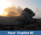 ng hello, presenting various fruits and vegetables for trade, and asking if they could get their portable DVD players charged. Well he probably didn’t experience the last part, but obviously the rugged beauty of this anchorage and the volcano made a huge impression upon Captain Cook since he named the harbor after his ship, the Resolution.
The main attraction in Tanna today is the volcano, Mt. Yasur, which supposedly is the most accessible active volcano in the world. Friends of ours who visited Mt. Yasur last year actually had a boulder size chunk of lava fall on the path behind them as they were hiking up to the craters edg e. Their advice to us was “When you hear an explosion don’t run, instead look up and watch where the chunks of lava are going and then dodge them if necessary”. They also said to visit the volcano at night because it’s easier to see the falling lava when it is dark. Needless to say, I was super excited to go see it and Jackie was a little bit nervous.
Once the anchor was set (and we started charging the DVD player), Bill, John and I hopped in the dingy and headed into the village to find a guy named Stanley who we were told could arrange transportation for us to Mt. Yasur. The village in Port Resolution is a typical custom village, not unlike what Captain Cook would have seen in his day, with most dwellings constructed out of native materials such as palm lea ves and pandanus trees. Some of the fancier homes use a bit of corrugated metal for siding. So it was really strange to see a Toyota extended cab pick-up truck parked outside of a traditional dwelling. There are only a couple of vehicles in Port Resolution (all of them 4 wheel drive pick-up trucks) and Stanley coordinates drivers to take “yachties” up to see the volcano. Eventually, we found Stanley and he arranged for someone to take us the next day.
So at 4pm the next day, Jackie, Bill, John and I climbed into one of the trucks with our driver who was also named John. It was a really rough ride on the “road” and the 4 wheel drive was definitely needed. At one point Bill asked Jackie if she wanted her seat belt to which she replied “ I am going to stick my h ead over the rim of a live volcano…I’ll pass on the seat belt”. The “road” led us through dense jungle, across previous lava flows, and thru a huge ash field before we began our ascent up the side of Mt. Yasur. Finally John (our driver) stopped the truck, pointed in the direction of a steep hill and said “There is the volcano..I will wait here”. So much for a guided tour.
After a short climb, we were literally standing on the rim of the volcano staring into the crater that was smoking and glowing with lava. The first explosion was definitely startling and we all stopped to watch as massive amounts of smoke, ash and lava were hurled hundreds of feet in the air above us. Fortunately, all of the falling lava was landing inside the rim. These explosions happened every few minutes and they 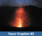 varied in size and intensity. Some with just a little smoke and others with tremendous amounts of lava and a wave of radiated heat. We hiked about a 1/3 of the way around the rim and found the perfect spot to sit and watch the sunset, which was followed by the most amazing “fireworks” display that I have ever seen. After a couple of hours, we reluctantly began our hike back to the truck under the light of the full moon. As we were hiking back down I kept thinking how amazing it was that we were on a live volcano with no guide, no caution signs, no fences or guardrails, and no liability waivers to sign. There is no way you would ever be allowed to do this in the US.
Speaking of the US, the island of Tanna is also known for a bizarre (just my opinion) religion that has a 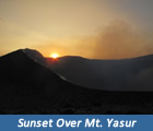 US connection. The religion apparently arose shortly after World War II when the US abandoned all of the military bases that it had constructed and occupied in Vanuatu. The followers of this religion worship a deity known as John Frum (short for John from America) and they believe that John Frum will one day bring the Americans back to Tanna with more ships and planes filled with treasures such as jeeps, radios, motorcycles, canned meat, candy and Coca-cola. They believe that he will return on February 15th of some future year, so every February 15th they have a huge celebration that culminates with the men marching around in military formation with bamboo rifles, saluting the Stars and Stripes and “USA” painted on their chests. Every Friday night, the faithful followers of John Frum come from all over Tanna to a place called Sulphur Bay at the base of Mt. Yasur to sing musical praises. This we had to see as there are not many places in the world today where it is actually popular to be an American. Not to mention, we had our own John with us who was “ from America”.
So once again, Jackie, Bill, John and I piled into a 4 wheel drive pick- up truck (this time with 8 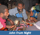 other people) and headed out on the ”road” to Sulphur Bay. An hour later, we were sitting around a dimly lit open hut listening to a group of John Frum followers playing guitars and singing. Throughout the night, each village on Tanna takes a turn playing several songs and the music doesn’t stop until around 7am. Apparently, in each village there is one person who can talk to John Frum and that person communicates to the village band the new songs that John Frum wants to hear on Friday night. To our untrained ears, all of the songs sounded exactly alike. So after a couple of hours, we piled into the back of the pickup truck for a beautiful (albeit long and bumpy) moonlit ride back to Port Resolution. If you would like to hear a sample of the music, just click on “John Frum Music” to the right.
![]()
A little later this morning we are heading north on an overnight sail to Port Vila on the island of Efate. There is a bit of weather coming in and we are hoping to get tucked in to Port Vila by early tomorrow morning….
Photos 62-123 have been added to the Fiji photo album in the Photo Gallery
Wednesday, August 29, 2012– Anelghowhat Bay, Aneityum, Van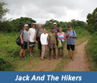 uatu
uatu
We had a great sail from Fiji to Aneityum making the 480 mile trip in less than 3 days. As luck would have it a line of squalls arrived at the entrance to the anchorage at the same time we did, so we hove-to for a little while and then snuck in between two of the squalls. After we got the anchor set the sun came out and revealed a beautiful anchorage with a small white sand beach island just offshore and crystal clear blue water. Since we had arrived on a Saturday we fully expected that we would have to stay on the boat until Monday morning when the Customs Office opened, but to our su rprise
the Customs Officer came to us a few hours after we arrived. Customs clearance into Vanuatu was very easy.
The history of Vanuatu is pretty interesting. In the late 1800’s both France and England laid claim to the islands and in the early 1900’s they finally worked out an agreement to jointly manage the island group calling it the New Hebrides. During WWII, the US had a very large presence in the islands while constructing and occupying a number of military bases in support of the war. In 1970’s the local population began fighting for independence and obtained it in 1980 as the Republic of Vanuatu.
Aneityum is the southern most island in Vanuatu and it reminds me a lot of the eastern parts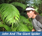 of Fiji
as there is very little development. There are no cars on the island and very few motorized boats. Most of the villagers here in Anelghowhat have handmade dugout canoes with an outrigger.
Ironically, a number of cruises ships visit Aneityum but they only visit the small white sand beach island that I mentioned earlier. The cruise lines have named that island “Mystery Island” and it is a really beautiful spot. One evening, we had a potluck dinner on Mystery Island with friends from a few of the other cruising boats anchored in Anelghowhat.
The Customs Officer had told us about a hike through the jungle to a really nice waterfall, so a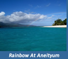
group of us from the potluck decided that we should do the hike. We had asked a few of the locals about how long the hike would take and the estimates varied from 3 to 8 hours. Due to this uncertainty, we arranged for a guide to take us there. We arrived at the beach this morning at 8 am to meet our guide, but by 9 am he still had not shown up. So we headed into the village where we met an older gentleman named Jack who tried to find us another guide. About 20 minutes later Jack came back and said that he could not find a guide for us, but he would take us up to the point where the trail got difficult. He said he wasn’t doing much today anyway. So Jack went back to his house, grabbed a machete, put on a pair of 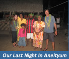 crocs (yes crocs…those plastic beach shoes), and we headed off into the jungle with Jack and his 3 dogs leading the way. Jack was great and he told us all about the various plants, animals, customs and history of the island. As we proceeded deeper into the jungle the trail got muddier, more overgrown, and a lot less obvious. After climbing down a steep and slippery slope to a stream crossing and staring up at an equally steep and slippery climb to continue on the trail, we asked Jack if this was the hard part. He just said no not yet and proceeded to start climbing. We had been hiking, climbing and crossing large streams for about 2 ½ hours, when Jack stopped and was quite unsure about which way the trail went from there. He headed off in one direction and someone asked “Jack are you sure that’s the right way?”. He responded “I think so, although
 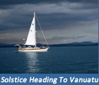 the last time I was up here was in 1968” . The groups confidence I n Jack’s navigation was now in question, but we continued on. A little while later someone asked how much further it was to the hard part and Jack responded “We have passed the hard part and the waterfall is only about 100 meters away”. The group was elated, but after hiking another kilometer and going through few more stream crossings, there was still no waterfall. A little while later someone asked Jack how much further to the waterfall and again his response was “only another 100 meters”. Eventually we made it to the waterfall and went swimming in the surprisingly cold water. By the time we got back to the beach we had been hiking for about 6 ½ hours.
Our day was not done as we rushed to boat for a quick shower and then back to the beach for a small dinner and dance that was being put on by the village. It was a great day. Tomorrow we are leaving Aneityum and heading for the island of Tanna where we have a date with a volcano….